Au
Au is a nature reserve in Wädenswil, Horgen District, Canton of Zurich. Au is situated nearby to the hamlet Au Peninsula, as well as near the neighborhood Brunnenhof.| Tap on a place to explore it |
Places of Interest
Highlights include Au ZH railway station and Schloss Au.
Au ZH railway station
Railway station

Photo: Roland zh, CC BY-SA 3.0.
Au ZH railway station is a railway station in Switzerland, situated in the village of Au in the municipality of Wädenswil in the canton of Zurich, near the Au Peninsula.
Schloss Au
Castle

Photo: Roland zh, CC BY-SA 3.0.
The Schloss Au, literally "Château Au", is a country estate located in Au, a locality of the municipality of Wädenswil in Switzerland. The spacious estate is situated on the Au Peninsula on Zürichsee lake shore in the Canton of Zurich.
Meilen railway station
Railway station

Photo: Paebi, CC BY-SA 3.0.
Meilen is a railway station in the Swiss canton of Zurich, situated in the municipality of Meilen on the eastern shore of Lake Zurich. The station is located on the Lake Zurich right bank railway line, within fare zone 141 of the Zürcher Verkehrsverbund.
Places in the Area
Nearby places include Horgen and Wädenswil.
Horgen

Photo: Roland zh, CC BY-SA 3.0.
Horgen is the principal town of the district of Horgen in the canton of Zurich in Switzerland. The inhabitants are called Horgner. The western village of Horgenberg belongs also to the municipality.
Wädenswil
Town

Photo: Voyager, CC BY-SA 3.0.
Wädenswil is a municipality located in the district of Horgen in the canton of Zürich in Switzerland. The population, as of 2013, was about 21,000. On 1 January 2019 the former municipalities of Hütten and Schönenberg were merged into the municipality of Wädenswil.
Meilen
Town
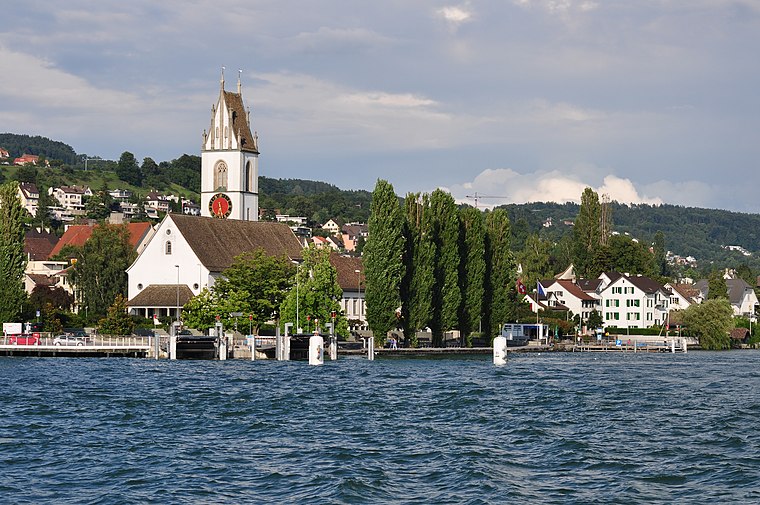
Photo: Roland zh, CC BY-SA 3.0.
Meilen is a municipality in the district of Meilen in the canton of Zürich in Switzerland.
Au
- Type: Nature reserve
- Category: recreation area
- Location: Wädenswil, Horgen District, Canton of Zurich, Switzerland, Central Europe, Europe
- View on OpenStreetMap
Latitude
47.2458° or 47° 14′ 45″ northLongitude
8.6528° or 8° 39′ 10″ eastOpen location code
8FVC6MW3+84OpenStreetMap ID
way 1413525051OpenStreetMap feature
leisure=nature_reserve
This page is based on OpenStreetMap, Wikidata, and Wikimedia Commons.
We’d love your help improving our open data sources. Thank you for contributing.
Satellite Map
Discover Au from above in high-definition satellite imagery.
Localities in the Area
Explore places such as Au Peninsula and Brunnenhof.
Notable Places Nearby
Highlights include TopCat F2 and ETG Au.
Switzerland: Must-Visit Destinations
Delve into Zurich, Berne, Geneva, and Basel.
Curious Nature Reserves to Discover
Uncover intriguing nature reserves from every corner of the globe.
About Mapcarta. Data © OpenStreetMap contributors and available under the Open Database License". Text is available under the CC BY-SA 4.0 license, except for photos, directions, and the map. Photo: Roland zh, CC BY-SA 3.0.