Wäldle am Köpfle
Wäldle am Köpfle is a forest in Stadtbergen, Markt, Augsburg, Bavaria. Wäldle am Köpfle is situated nearby to the neighborhood Schafweidesiedlung, as well as near the quarter Radau.| Tap on a place to explore it |
Places of Interest
Highlights include Augsburg Arena and Rosenaustadion.
Augsburg Arena
Stadium

Photo: Futbol vic, CC BY-SA 3.0.
Augsburg Arena, currently known commercially as the WWK Arena, is a football stadium in Augsburg, Bavaria, Germany. It is used mostly for football matches and hosts the home matches of FC Augsburg.
Rosenaustadion
Stadium
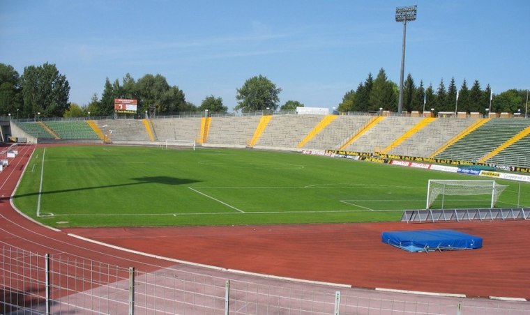
Photo: Wikimedia, CC BY-SA 3.0.
Rosenaustadion is a multi-purpose stadium in Augsburg, Bavaria, Germany. Built in 1951, it is a heritage listed monument and was the largest stadium in Augsburg for 58 years until 2009 when the Augsburg Arena was opened.

Places in the Area
Nearby places include Augsburg and Stadtbergen.
Augsburg
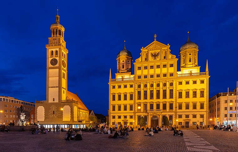
Photo: Wikimedia, CC BY-SA 4.0.
Augsburg is a lovely metropolitan city of 300,000 people and around 885,000 in the urban area in the German Bundesland of Bavaria. Some 60 km northwest of Munich, it is one of the oldest German cities.
Stadtbergen
Town
 Stadtbergen is a town in the district of Augsburg, in Bavaria, Germany. It is situated in the outskirts of Augsburg, 4 kilometres west of Augsburg city centre. Stadtbergen was granted town privileges in May 2007.
Pfersee
Suburb
Pfersee is a part of the city of Augsburg, Bavaria with some 25.000 inhabitants on the western shore of river Wertach. In 1911 Pfersee was incorporated to Augsburg.
Wäldle am Köpfle
- Type: Forest
- Location: Stadtbergen, Markt, Augsburg, Bavarian Swabia, Bavaria, Germany, Central Europe, Europe
- View on OpenStreetMap
Latitude
48.3434° or 48° 20′ 36″ northLongitude
10.855° or 10° 51′ 18″ eastOpen location code
8FWG8VV3+8XOpenStreetMap ID
way 1414407989OpenStreetMap feature
natural=wood
This page is based on OpenStreetMap, Wikidata, and Wikimedia Commons.
We’d love your help improving our open data sources. Thank you for contributing.
Satellite Map
Discover Wäldle am Köpfle from above in high-definition satellite imagery.
Localities in the Area
Explore places such as Schafweidesiedlung and Radau.
Notable Places Nearby
Highlights include Herbert-Link-Tennisanlage and TSV Leitershofen.
Bavarian Swabia: Must-Visit Destinations
Delve into Augsburg, Memmingen, Kempten, and Füssen.
Curious Forests to Discover
Uncover intriguing forests from every corner of the globe.
About Mapcarta. Data © OpenStreetMap contributors and available under the Open Database License". Text is available under the CC BY-SA 4.0 license, except for photos, directions, and the map. Photo: Tilman2007, CC BY-SA 3.0.