Passerelle du Montenvers
Passerelle du Montenvers is a bridge in Chamonix, Arrondissement of Bonneville, Auvergne-Rhône-Alpes. Passerelle du Montenvers is situated nearby to the railway station Chamonix-Montenvers, as well as near Locomotive n°7.| Tap on a place to explore it |
Places of Interest Nearby
Highlights include Chamonix-Mont-Blanc station and Temple protestant de Chamonix.
Chamonix-Mont-Blanc station
Railway station
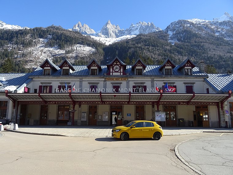
Photo: Remontees, CC BY-SA 4.0.
Chamonix-Mont-Blanc station is a railway station in the commune of Chamonix-Mont-Blanc, in the French department of Haute-Savoie. It is located on the 1,000 mm gauge Saint-Gervais–Vallorcine line of SNCF.
Temple protestant de Chamonix
Church

Photo: Guilhem Vellut, CC BY 2.0.
Temple protestant de Chamonix is a church, which is situated 120 metres west of Passerelle du Montenvers.
Cimetière de Chamonix
Cemetery
 Cimetière de Chamonix is a cemetery, which is situated 220 metres southeast of Passerelle du Montenvers.
Places in the Area
Nearby places include Les Praz and Argentière.
Les Praz
Hamlet

Photo: Kulmalukko, CC BY-SA 3.0.
Les-Praz-de-Chamonix is a mountain village in the French Alps, part of the commune of Chamonix. Altitude: 1060 m.
Argentière
Village

Photo: Kulmalukko, CC BY-SA 3.0.
Argentière is a picturesque skiing, alpine walking and mountaineering village in the French Alps, part of the commune of Chamonix-Mont-Blanc, at an altitude of 1,252 m. Argentière is situated 8 km northeast of Passerelle du Montenvers.
Grand Couloir
Locality
The Grand Couloir is a couloir on the Aiguille du Goûter. At 3,340 metres altitude, this gully has to be traversed on foot to reach the scramble beyond the Tête Rousse Hut up to the Goûter Refuge on the Goûter Route on Mont Blanc. Grand Couloir is situated 9 km southwest of Passerelle du Montenvers.
Passerelle du Montenvers
- Type: Bridge
- Category: transportation
- Location: Chamonix, Arrondissement of Bonneville, Haute-Savoie, Auvergne-Rhône-Alpes, France, Europe
- View on OpenStreetMap
Latitude
45.92305° or 45° 55′ 23″ northLongitude
6.87479° or 6° 52′ 29″ eastOpen location code
8FQ8WVFF+6WOpenStreetMap ID
way 1416306790OpenStreetMap feature
man_made=bridge
This page is based on OpenStreetMap, Wikidata, and Wikimedia Commons.
We’d love your help improving our open data sources. Thank you for contributing.
Satellite Map
Discover Passerelle du Montenvers from above in high-definition satellite imagery.
Notable Places Nearby
Highlights include Locomotive n°7 and Chamonix-Montenvers.
Nearby Places
Explore places such as Caisse des forfaits CMB Montenvers and Chamonix-Montenvers.
Haute-Savoie: Must-Visit Destinations
Delve into Annecy, Annemasse, Evian, and Megève.
Curious Bridges to Discover
Uncover intriguing bridges from every corner of the globe.
About Mapcarta. Data © OpenStreetMap contributors and available under the Open Database License". Text is available under the CC BY-SA 4.0 license, except for photos, directions, and the map. Photo: Ximonic, CC BY 2.5.