Chata U Sovy
Chata U Sovy is a building in Ludvíkov, Bruntál District, Moravian-Silesian Region. Chata U Sovy is situated nearby to the peak Vysoká hora [Ludvíkov], as well as near Hláska.| Tap on a place to explore it |
Places of Interest Nearby
Highlights include Church of the Visitation of Our Lady (Ludvíkov) and Anenský vrch.
Church of the Visitation of Our Lady (Ludvíkov)
Church
 Church of the Visitation of Our Lady (Ludvíkov) is situated 2 km northeast of Chata U Sovy.
Anenský vrch
Peak
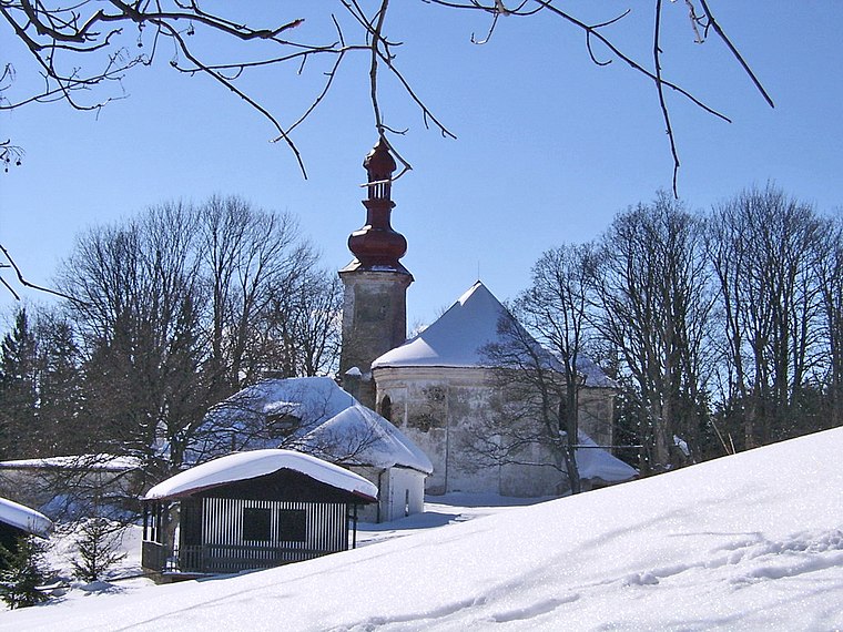
Photo: Bertik, CC BY-SA 3.0.
Anenský vrch is a mountain in the Hrubý Jeseník mountain range in the Czech Republic. It has an elevation of 861 m above sea level. It is located in the municipal territory of Andělská Hora. Anenský vrch is situated 4 km southeast of Chata U Sovy.
Lázeňský dům Libuše
Public building

Photo: Pudelek, CC BY-SA 4.0.
Lázeňský dům Libuše is a public building, which is situated 3 km southwest of Chata U Sovy.
Places in the Area
Nearby places include Ludvíkov and Karlova Studánka.
Ludvíkov
Village
Ludvíkov is a municipality and village in Bruntál District in the Moravian-Silesian Region of the Czech Republic. It has about 300 inhabitants. It lies in the Hrubý Jeseník mountain range.
Karlova Studánka
Village

Photo: Pudelek, CC BY-SA 4.0.
Karlova Studánka is a spa municipality and village in Bruntál District in the Moravian-Silesian Region of the Czech Republic. It has about 200 inhabitants. The village is well preserved and protected as a village monument zone. Karlova Studánka is situated 3½ km southwest of Chata U Sovy.
Hubertov
Hamlet

Photo: Stribrohorak, CC BY-SA 4.0.
Hubertov is a hamlet, which is situated 3½ km southwest of Chata U Sovy.
Chata U Sovy
Latitude
50.09582° or 50° 5′ 45″ northLongitude
17.33578° or 17° 20′ 9″ eastInception
December 31st, 1989Levels
1Open location code
9F2V38WP+88OpenStreetMap ID
way 141823319OpenStreetMap feature
building=yes
This page is based on OpenStreetMap, Wikidata, and Wikimedia Commons.
We’d love your help improving our open data sources. Thank you for contributing.
Satellite Map
Discover Chata U Sovy from above in high-definition satellite imagery.
Notable Places Nearby
Highlights include Vysoká hora [Ludvíkov] and Obecní úřad Ludvíkov.
Nearby Places
Explore places such as Penzion Stonožka and Rekreační středisko Jitřenka.
Czech Republic: Must-Visit Destinations
Delve into Prague, Brno, Pilsen, and Ostrava.
Curious Buildings to Discover
Uncover intriguing buildings from every corner of the globe.
About Mapcarta. Data © OpenStreetMap contributors and available under the Open Database License". Text is available under the CC BY-SA 4.0 license, except for photos, directions, and the map. Photo: john mcsporran, CC BY 2.0.