Hofreiter
Hofreiter is a greengrocer in Munich, Upper Bavaria, Bavaria. Hofreiter is situated nearby to the grassland Freude am Hund, as well as near the garden Bienengarten Pasing.| Tap on a place to explore it |
Places of Interest Nearby
Highlights include Westbad (Munich) and Pasing Town Hall Community Centre (old building).
Westbad (Munich)
Sports venue

Photo: High Contrast, CC BY 3.0 de.
Westbad (Munich) is a sports venue, which is situated 1 km northeast of Hofreiter.
Pasing Town Hall Community Centre (old building)
Town hall

Photo: High Contrast, CC BY 3.0 de.
Pasing Town Hall is the former town hall of the municipality of Pasing, Bavaria, Germany, which was incorporated into Munich in 1938. Pasing Town Hall Community Centre (old building) is situated 1½ km north of Hofreiter.
München-Pasing station
Railway station
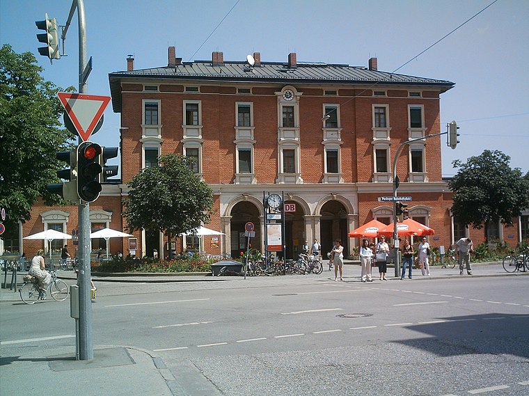
Photo: Rdb, CC BY-SA 3.0.
Munich-Pasing is a railway station in the west of Munich. It is the third-largest station in the city, after München Hauptbahnhof and München Ost. München-Pasing station is situated 2 km north of Hofreiter.
Places in the Area
Nearby places include Blumenau and Pasing.

Pasing
Suburb
Photo: Rdb, CC BY-SA 3.0.
Pasing is a district in the city of Munich, Germany, and part of the borough Pasing-Obermenzing.
Hofreiter
- Type: Greengrocer
- Categories: building, shop, and food
- Location: Munich, Upper Bavaria, Bavaria, Germany, Central Europe, Europe
- View on OpenStreetMap
Latitude
48.13369° or 48° 8′ 1″ northLongitude
11.46715° or 11° 28′ 2″ eastOpen location code
8FWH4FM8+FVOpenStreetMap ID
way 1421503742OpenStreetMap feature
building=yesOpenStreetMap feature
shop=greengrocer
This page is based on OpenStreetMap, Wikidata, and Wikimedia Commons.
We’d love your help improving our open data sources. Thank you for contributing.
Satellite Map
Discover Hofreiter from above in high-definition satellite imagery.
Places with the Same Name
Discover other places named “Hofreiter”.
Notable Places Nearby
Highlights include Freude am Hund and Bienengarten Pasing.
Nearby Places
Explore places such as Seeholzenweg and Seeholzenweg.
Munich: Must-Visit Destinations
Delve into North Munich, Altstadt, Haidhausen, and Ludwigsvorstadt-Isarvorstadt.
Curious Greengrocers to Discover
Uncover intriguing greengrocers from every corner of the globe.
About Mapcarta. Data © OpenStreetMap contributors and available under the Open Database License". Text is available under the CC BY-SA 4.0 license, except for photos, directions, and the map. Photo: Heav84, CC BY-SA 3.0.