Timmers Busch
Timmers Busch is a forest in Neuenkirchen, Heidekreis, Lower Saxony. Timmers Busch is situated nearby to the hamlet Molkenreith, as well as near the village Grauen.| Tap on a place to explore it |
Places of Interest
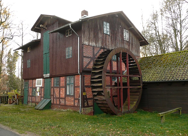
Highlights include Lünzen Watermill and Grundschule Lünzen.

Timmers Busch
- Type: Forest
- Location: Neuenkirchen, Heidekreis, Lower Saxony, Germany, Central Europe, Europe
- View on OpenStreetMap
Latitude
53.1034° or 53° 6′ 12″ northLongitude
9.6665° or 9° 39′ 59″ eastOpen location code
9F5F4M38+9HOpenStreetMap ID
way 1422537982OpenStreetMap feature
landuse=forest
This page is based on OpenStreetMap, Wikidata, and Wikimedia Commons.
We’d love your help improving our open data sources. Thank you for contributing.
Satellite Map
Discover Timmers Busch from above in high-definition satellite imagery.
Localities in the Area
Explore places such as Molkenreith and Grauen.
Notable Places Nearby
Highlights include Freiwillige Feuerwehr Grauen and Sportverein Lünzen.
Lower Saxony: Must-Visit Destinations
Delve into Hanover, Göttingen, Brunswick, and Wolfsburg.
Curious Forests to Discover
Uncover intriguing forests from every corner of the globe.
About Mapcarta. Data © OpenStreetMap contributors and available under the Open Database License". Text is available under the CC BY-SA 4.0 license, except for photos, directions, and the map. Photo: Danapit, CC BY-SA 3.0.