La Luaise
La Luaise is in Tréveneuc, Arrondissement of Saint-Brieuc, Brittany. La Luaise is situated nearby to the islet îlot du Châtelet, as well as near the beach Plage de Saint-Marc.| Tap on a place to explore it |
Places of Interest Nearby
Highlights include Chapelle Saint-Marc de Tréveneuc and Église Saint-Colomban de Tréveneuc.
Chapelle Saint-Marc de Tréveneuc
Church

Photo: Gwentux, CC BY-SA 4.0.
Chapelle Saint-Marc de Tréveneuc is a church, which is situated 290 metres southwest of La Luaise.
Église Saint-Colomban de Tréveneuc
Church

Photo: Wikimedia, CC BY-SA 3.0.
Église Saint-Colomban de Tréveneuc is a church, which is situated 1½ km west of La Luaise.
Piscine d’eau de mer
Swimming pool
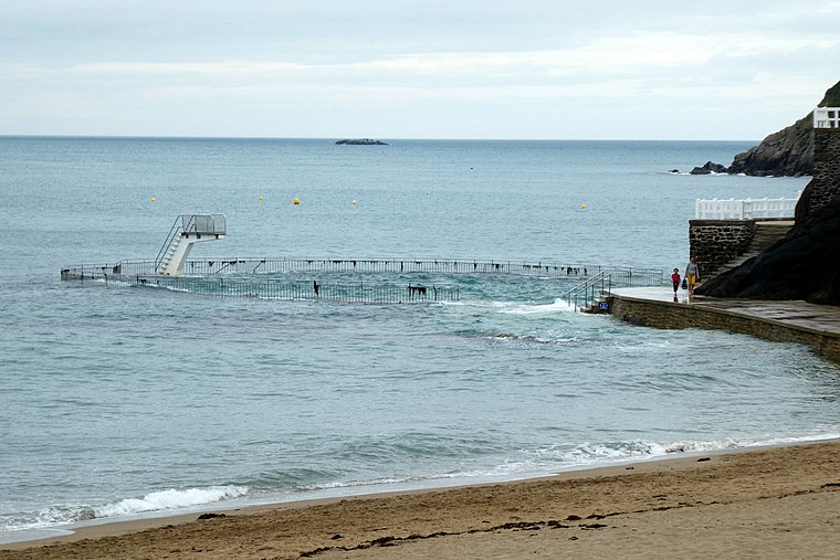 Piscine d’eau de mer is a swimming pool, which is situated 2 km southeast of La Luaise.
Places in the Area
Nearby places include Binic.
Binic
Village

Photo: Tango7174, CC BY-SA 4.0.
Binic is a small fishing port 12 km north of Saint-Brieuc on the north coast of Côtes-d'Armor department of Brittany, in northwest France. Once a commune of its own, Binic is now part of the commune of Binic-Étables-sur-Mer, following a merger on March, 01, 2016. Binic is situated 8 km south of La Luaise.
La Luaise
- Type: Rock
- Category: landform
- Location: Tréveneuc, Arrondissement of Saint-Brieuc, Côtes-d’Armor, Brittany, France, Europe
- View on OpenStreetMap
Latitude
48.66841° or 48° 40′ 6″ northLongitude
-2.85261° or 2° 51′ 9″ westOpen location code
8CWVM49W+9XOpenStreetMap ID
way 1422804319OpenStreetMap feature
natural=bare_rock
This page is based on OpenStreetMap, Wikidata, and Wikimedia Commons.
We’d love your help improving our open data sources. Thank you for contributing.
Satellite Map
Discover La Luaise from above in high-definition satellite imagery.
Notable Places Nearby
Highlights include îlot du Châtelet and Plage de Saint-Marc.
Nearby Places
Explore places such as Les Viviers de Saint-Marc and Saint-Marc.
Brittany: Must-Visit Destinations
Delve into Rennes, Brest, Finistère, and Morbihan.
Curious Places to Discover
Uncover intriguing places from every corner of the globe.
About Mapcarta. Data © OpenStreetMap contributors and available under the Open Database License". Text is available under the CC BY-SA 4.0 license, except for photos, directions, and the map. Photo: Spendeau, CC BY-SA 3.0.