Kranøen
Kranøen is an islet in Næstved Municipality, Region Zealand. Kranøen is situated nearby to Lille Næstved School, Herlufsholmvej branch, as well as near the park Rådmandshaven.| Tap on a place to explore it |
Places of Interest Nearby
Highlights include Boderne and Helligaandshuset Naestved.
Boderne
Museum

Photo: Toxophilus, CC BY-SA 4.0.
Boderne is a museum, which is situated 480 metres southeast of Kranøen.
Helligaandshuset Naestved
Museum
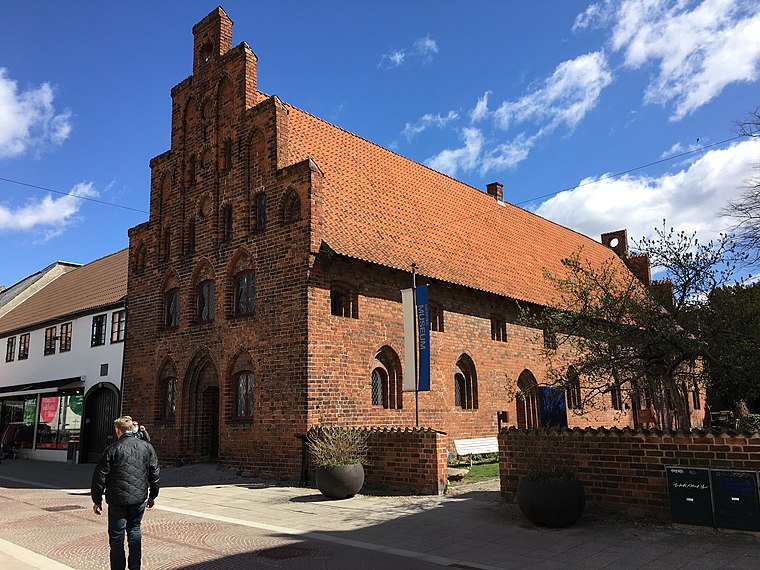
Photo: Toxophilus, CC BY-SA 4.0.
Helligaandshuset Naestved is a museum, which is situated 480 metres east of Kranøen.
St. Peter’s Church
Church

Photo: Toxophilus, CC BY-SA 4.0.
St. Peter's Church is located at Næstved on the Danish island of Zealand. St. Peter's is situated in the Næstved parish of the Diocese of Roskilde of the Church of Denmark. The church is one of Denmark's foremost Gothic buildings. St. Peter’s Church is situated 480 metres southeast of Kranøen.
Places in the Area
Nearby places include Næstved and Rønnebæk.
Næstved

Photo: Mads Sabroe, CC BY-SA 3.0.
Næstved is a town in the municipality of the same name, located in the southern part of the island of Zealand in Denmark. Næstved has several adult education centers, five elementary schools - and has at least one of each type of the four upper-second-level education centers.
Rønnebæk
Village

Photo: Bococo, CC BY-SA 3.0.
Rønnebæk is a village and small satellite community to Næstved, with a population of 592, in Næstved Municipality, Region Zealand in Denmark. It is located 5 km southeast of central Næstved. Rønnebæk is situated 4 km southeast of Kranøen.
Fensmark
Village

Photo: Beethoven9, CC BY-SA 4.0.
Fensmark is the second largest town in Næstved Municipality on the south central part of the Danish island of Zealand. It is located about 6 km northeast of Næstved and has a population of 5,190 Fensmark was the municipal seat of the former Holmegaard Municipality, until it was merged with four other municipalities to form the new Næstved Municipality on 1 January 2007. Fensmark is situated 6 km northeast of Kranøen.
Kranøen
- Type: Islet
- Categories: park, recreation area, locality, and landform
- Location: Næstved Municipality, Region Zealand, Denmark, Nordic countries, Europe
- View on OpenStreetMap
Latitude
55.23272° or 55° 13′ 58″ northLongitude
11.7512° or 11° 45′ 4″ eastOpen location code
9F7H6QM2+3FOpenStreetMap ID
way 1423382651OpenStreetMap feature
leisure=parkOpenStreetMap feature
place=islet
This page is based on OpenStreetMap, Wikidata, and Wikimedia Commons.
We’d love your help improving our open data sources. Thank you for contributing.
Satellite Map
Discover Kranøen from above in high-definition satellite imagery.
Notable Places Nearby
Highlights include Lille Næstved School, Herlufsholmvej branch and Rådmandshaven.
Nearby Places
Explore places such as Slusehuset and Herlufsholmvej.
Denmark: Must-Visit Destinations
Delve into Copenhagen, Aarhus, Odense, and Aalborg.
Curious Islets to Discover
Uncover intriguing islets from every corner of the globe.
About Mapcarta. Data © OpenStreetMap contributors and available under the Open Database License". Text is available under the CC BY-SA 4.0 license, except for photos, directions, and the map. Photo: Inkey, CC BY 2.0.