South Fork Wind onshore substation
South Fork Wind onshore substation is an electrical substation in East Hampton, Suffolk County, New York. South Fork Wind onshore substation is situated nearby to the power station East Hampton Diesels & Gas Turbine, as well as near the village East Hampton North.| Tap on a place to explore it |
Places of Interest Nearby
Highlights include East Hampton station and Jewish Center of the Hamptons.
East Hampton station
Railway station
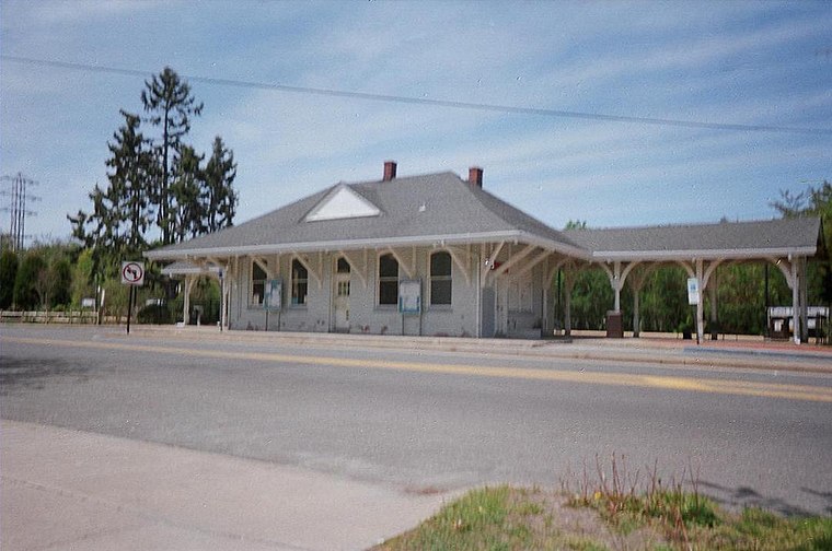
Photo: DanTD, CC BY-SA 3.0.
East Hampton is a station on the Montauk Branch of the Long Island Rail Road, on Railroad Avenue between Newtown Lane and Race Lane, in East Hampton, Suffolk County, New York. East Hampton station is situated 1 mile east of South Fork Wind onshore substation.
Jewish Center of the Hamptons
Synagogue
The Jewish Center of the Hamptons, abbreviated as JCOH, also called Shaarey Pardes, is a post-denominational Jewish congregation, synagogue, and community center, located at 44 Woods Lane, in East Hampton, Long Island, in New York, in the United States. Jewish Center of the Hamptons is situated 1 mile southeast of South Fork Wind onshore substation.
Mulford Farmhouse
Museum
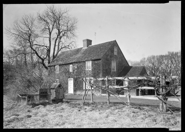
Photo: Wikimedia, Public domain.
Mulford Farm in East Hampton, Long Island, New York, is one of America's most significant, intact English colonial farmsteads. The farmhouse was built in 1680 by High Sheriff Josiah Hobart, an important early official of the first New York Royal Province government. Mulford Farmhouse is situated 1 mile east of South Fork Wind onshore substation.
Places in the Area
Nearby places include East Hampton North and Freetown.
East Hampton North
Village
East Hampton North is a census-designated place in Suffolk County, New York, United States. At the 2010 census, the population was 4,142.
Freetown
Hamlet
Freetown is an unincorporated hamlet in the Town of East Hampton, NY, settled in the 19th century by free people of African and Native American descent, as well as people of European descent. Freetown is situated 2 miles northeast of South Fork Wind onshore substation.
Wainscott
Hamlet
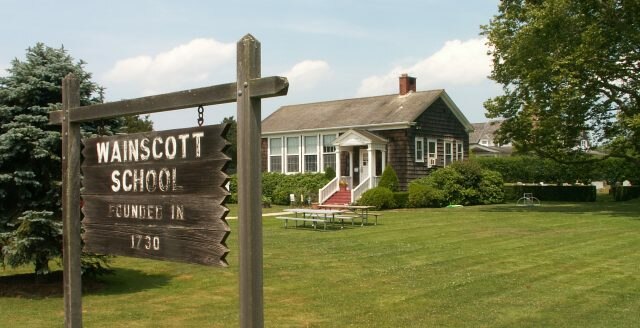
Photo: Americasroof, CC BY-SA 2.5.
Wainscott is a hamlet in the Town of East Hampton in Suffolk County, New York, United States, on the South Fork of Long Island. As of the 2010 United States Census, the CDP population was 650. Wainscott is situated 2½ miles southwest of South Fork Wind onshore substation.
South Fork Wind onshore substation
- Type: Electrical substation
- Category: industry
- Location: East Hampton, Suffolk County, New York, Mid-Atlantic, United States, North America
- View on OpenStreetMap
Latitude
40.96121° or 40° 57′ 40″ northLongitude
-72.21128° or 72° 12′ 41″ westOpen location code
87G9XQ6Q+FFOpenStreetMap ID
way 1424883899OpenStreetMap feature
landuse=industrial
This page is based on OpenStreetMap, Wikidata, and Wikimedia Commons.
We’d love your help improving our open data sources. Thank you for contributing.
Satellite Map
Discover South Fork Wind onshore substation from above in high-definition satellite imagery.
Notable Places Nearby
Highlights include East Hampton Diesels & Gas Turbine and Most Holy Trinity Church.
Nearby Places
Explore places such as East Hampton Substation and Red Horse Market.
Suffolk County: Must-Visit Destinations
Delve into Huntington, Montauk, Southampton, and Stony Brook.
Curious Electrical Substations to Discover
Uncover intriguing electrical substations from every corner of the globe.
About Mapcarta. Data © OpenStreetMap contributors and available under the Open Database License". Text is available under the CC BY-SA 4.0 license, except for photos, directions, and the map. Photo: Wikimedia, CC0.