Clearman Field
Clearman Field is a sports venue in Belleville Township, Essex County, New Jersey which is located on Union Avenue. Clearman Field is situated nearby to the church River of Life Assembly of God, as well as near Bethany Lutheran Church.| Tap on a place to explore it |
Places of Interest Nearby
Highlights include Clara Maass Medical Center and Branch Brook Park station.
Clara Maass Medical Center
Hospital
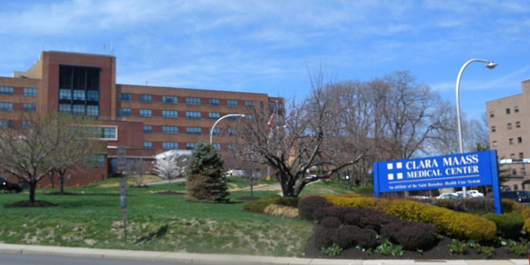
Photo: Jim.henderson, CC0.
Clara Maass Medical Center is a 342- bed hospital in Belleville, Essex County, New Jersey, United States, that is part of the RWJBarnabas Health system. Clara Maass Medical Center is situated 1 mile southwest of Clearman Field.
Branch Brook Park station
Railway station

Photo: Wikimedia, CC BY-SA 2.0.
Branch Brook Park station is a light rail station in the Forest Hill neighborhood of Newark, New Jersey. The station services trains of the Newark Light Rail, operated by NJ Transit and is the last in the city of Newark heading westbound. Branch Brook Park station is situated 1¼ miles southwest of Clearman Field.
Branch Brook Park
Park

Photo: Hypnotica Studios Infinite, CC BY 2.0.
Branch Brook Park is a county park of Essex County, New Jersey. It is located in the North Ward of Newark, between the neighborhoods of Forest Hill and Roseville. Branch Brook Park is situated 1½ miles southwest of Clearman Field.
Places in the Area
Nearby places include Belleville and North Arlington.
Belleville
Town

Photo: Jim.henderson, CC0.
Belleville is a township in Essex County, in the U.S. state of New Jersey. As of the 2020 United States census, the township's population was 38,222. an increase of 2,296 from the 2010 census count of 35,926,…
North Arlington
Town

Photo: Jim.henderson, CC0.
North Arlington is a borough in Bergen County, in the U.S. state of New Jersey. As of the 2020 United States census, the borough's population was 16,457, an increase of 1,065 from the 2010 census count of 15,392, which in turn reflected an increase of 211 from the 15,181 counted in the 2000 census.
Kearny
Town
Photo: Jim.henderson, Public domain.
Kearny is a town in the western part of Hudson County, in the U.S. state of New Jersey, and a suburb of Newark. As of the 2020 United States census, the town's population was 41,999, an increase of 1,315 from the 2010 census count of 40,684, which in turn reflected an increase of 171 from the 40,513 counted in the 2000 census. Kearny is situated 1½ miles south of Clearman Field.
Clearman Field
- Type: Sports venue
- Address: 183 Union Avenue, Belleville, NJ 07109
- Categories: recreation area and sports location
- Location: Belleville Township, Essex County, Gateway, New Jersey, Mid-Atlantic, United States, North America
- View on OpenStreetMap
Latitude
40.79171° or 40° 47′ 30″ northLongitude
-74.15804° or 74° 9′ 29″ westOperator
Belleville School District/TownshipOpen location code
87G7QRRR+MQOpenStreetMap ID
way 1426843818OpenStreetMap feature
leisure=sports_centre
This page is based on OpenStreetMap, Wikidata, and Wikimedia Commons.
We’d love your help improving our open data sources. Thank you for contributing.
Satellite Map
Discover Clearman Field from above in high-definition satellite imagery.
Notable Places Nearby
Highlights include River of Life Assembly of God and Bethany Lutheran Church.
Nearby Places
Explore places such as Union Ave at Holmes St and Union Ave at Lloyd Pl.
Essex County: Must-Visit Destinations
Delve into Newark, Newark Liberty International Airport, Montclair, and Maplewood.
Curious Sports Venues to Discover
Uncover intriguing sports venues from every corner of the globe.
About Mapcarta. Data © OpenStreetMap contributors and available under the Open Database License". Text is available under the CC BY-SA 4.0 license, except for photos, directions, and the map. Photo: King of Hearts, CC BY-SA 3.0.