John Buhler Research Centre
John Buhler Research Centre is a research institute in Manitoba, Prairies. John Buhler Research Centre is situated nearby to Neil John McLean Library, as well as near the hotel Canad Inns Destination Centre Health Sciences Centre.| Tap on a place to explore it |
Places of Interest Nearby
Highlights include HSC Winnipeg Children’s Hospital and Canada Life Centre.
HSC Winnipeg Children’s Hospital
Hospital building
HSC Winnipeg Children's Hospital, formerly known as the Children's Hospital of Winnipeg, is a children's hospital that forms part of the Health Sciences Centre integrated health care facility in Winnipeg, Manitoba. HSC Winnipeg Children’s Hospital is situated 270 metres east of John Buhler Research Centre.
Canada Life Centre
Stadium
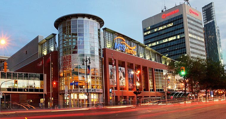 Canada Life Centre is an indoor arena in downtown Winnipeg, Manitoba, Canada. It is the home of the National Hockey League's Winnipeg Jets and their American Hockey League affiliate, the Manitoba Moose. Canada Life Centre is situated 1½ km southeast of John Buhler Research Centre.
Canadian Science Centre for Human and Animal Health
The Canadian Science Centre for Human and Animal Health is an infectious disease laboratory complex in Winnipeg, Manitoba, owned and operated by the Government of Canada. Canadian Science Centre for Human and Animal Health is situated 500 metres northwest of John Buhler Research Centre.Places in the Area
Nearby places include West End and Chinatown.
West End
Suburb
 The West End is a mainly residential area of Downtown Winnipeg, Manitoba, Canada. It includes the neighbourhoods of Armstrong's Point, Colony, Daniel McIntyre, Minto, Sargent Park, Spence, St.
Chinatown
Neighborhood

Photo: Wikimedia, Public domain.
Chinatown is a neighbourhood in Winnipeg, Manitoba, that was formed in 1909 and serves as an enclave of Chinese expatriates. Located on King Street between James and Higgins Avenues, adjacent to the Exchange District, it was officially recognized in 1968.
Exchange District
Neighborhood

Photo: Interlaker, CC0.
The Exchange District is a National Historic Site of Canada in the downtown area of Winnipeg, Manitoba, Canada. Just one block north of Portage and Main, the Exchange District comprises twenty city blocks and approximately 150 heritage buildings, and it is known for its intact early 20th century collection of warehouses, financial institutions, and early terracotta-clad skyscrapers.
John Buhler Research Centre
- Type: Research institute
- Category: education
- Location: Manitoba, Prairies, Canada, North America
- View on OpenStreetMap
Latitude
49.90401° or 49° 54′ 14″ northLongitude
-97.16007° or 97° 9′ 36″ westOpen location code
86X4WR3Q+JXOpenStreetMap ID
way 1427619511OpenStreetMap feature
amenity=research_institute
This page is based on OpenStreetMap, Wikidata, and Wikimedia Commons.
We’d love your help improving our open data sources. Thank you for contributing.
Satellite Map
Discover John Buhler Research Centre from above in high-definition satellite imagery.
Notable Places Nearby
Highlights include Neil John McLean Library and Canad Inns Destination Centre Health Sciences Centre.
Nearby Places
Explore places such as Brodie Centre and Bagelsmith.
Manitoba: Must-Visit Destinations
Delve into Winnipeg, Churchill, Brandon, and Thompson.
Curious Research Institutes to Discover
Uncover intriguing research institutes from every corner of the globe.
About Mapcarta. Data © OpenStreetMap contributors and available under the Open Database License". Text is available under the CC BY-SA 4.0 license, except for photos, directions, and the map. Photo: Wikimedia, CC0.