Eagle Street Express
Eagle Street Express is a convenience store in Utica, Oneida, New York which is located on Eagle Street. Eagle Street Express is situated nearby to Saint Marys Cemetery, as well as near Utica Fire Station Number 3.| Tap on a place to explore it |
- Type: Convenience store
- Address: 904 Eagle Street, Utica, NY 13501
- Roof shape: gabled
- Wheelchair access: yes
Places of Interest Nearby
Highlights include Thomas R Proctor High School and Utica Armory.
Thomas R Proctor High School
School

Photo: Wikimedia, CC BY-SA 3.0.
Thomas R. Proctor High School is the only high school in the Utica City School District in Utica, New York. The school was built in 1934 with funds from the Works Progress Administration and Thomas R. Thomas R Proctor High School is situated 2,000 feet southeast of Eagle Street Express.
Utica Armory
Military installation

Photo: Agreen54, CC BY-SA 4.0.
Utica Armory is a historic National Guard armory building located in Utica in Oneida County, New York. It is a structural steel structure with brick curtain walls built in 1930 for Troop A, 121st Cavalry, and designed by State architect William Haugaard. Utica Armory is situated 3,700 feet southeast of Eagle Street Express.
Stanley Theater
Theater building
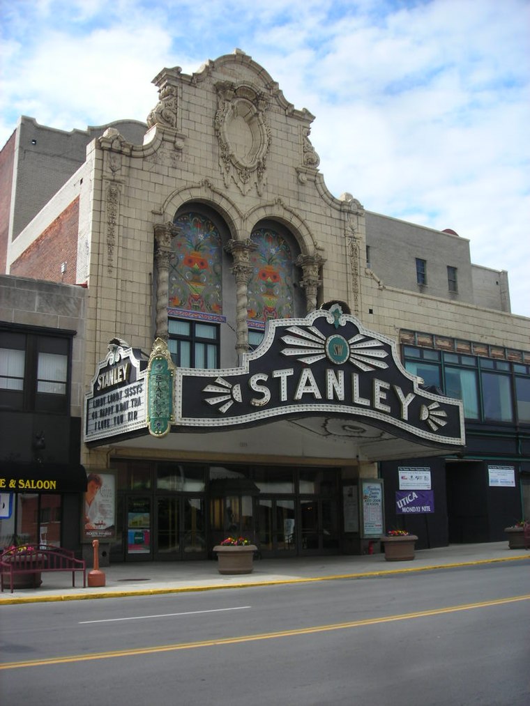
Photo: Doug Kerr, CC BY-SA 2.0.
The Stanley Theatre is a historic Baroque movie palace in Utica, New York. Over the years, it has gone through several changes of ownership, but has always been affiliated with Warner Brothers Pictures. Stanley Theater is situated 1¼ miles northwest of Eagle Street Express.
Places in the Area
Nearby places include Yorkville and New York Mills.
Yorkville
Village
Yorkville is a village in Oneida County, New York, United States. The population was 2,689 at the 2010 census. The village of Yorkville is in the southeastern part of the town of Whitestown, adjacent to the city of Utica. Yorkville is situated 3 miles northwest of Eagle Street Express.
New York Mills
Village
New York Mills is a village in Oneida County, New York, United States. The population was 3,327 at the 2010 census. The village of New York Mills is situated partly within the town of Whitestown and partly within the town of New Hartford. New York Mills is situated 4 miles west of Eagle Street Express.
Washington Mills
Village
Washington Mills is a hamlet and census-designated place in the Town of New Hartford, a suburb of Utica, New York, United States. Washington Mills is located off New York State Route 8. Washington Mills is situated 4 miles southwest of Eagle Street Express.
Eagle Street Express
- Categories: building, shop, retail building, and food
- Location: Utica, Oneida, Central New York, New York, Mid-Atlantic, United States, North America
- View on OpenStreetMap
Latitude
43.08651° or 43° 5′ 11″ northLongitude
-75.21872° or 75° 13′ 7″ westOpen location code
87M63QPJ+JGOpenStreetMap ID
way 1434161207OpenStreetMap feature
building=retailOpenStreetMap feature
shop=convenienceOpenStreetMap attribute
roof-shape=gabledOpenStreetMap attribute
wheelchair=yes
This page is based on OpenStreetMap, Wikidata, and Wikimedia Commons.
We’d love your help improving our open data sources. Thank you for contributing.
Satellite Map
Discover Eagle Street Express from above in high-definition satellite imagery.
Notable Places Nearby
Highlights include Saint Marys Cemetery and Utica Fire Station Number 3.
Nearby Places
Explore places such as Dunkin‘ Donuts and KeyBank.
Central New York: Must-Visit Destinations
Delve into Syracuse, Rome, Oswego, and Norwich.
Curious Convenience Stores to Discover
Uncover intriguing convenience stores from every corner of the globe.
About Mapcarta. Data © OpenStreetMap contributors and available under the Open Database License". Text is available under the CC BY-SA 4.0 license, except for photos, directions, and the map. Photo: Vasiliymeshko, CC BY-SA 3.0.