Foderbrættet
Foderbrættet is a fast food restaurant in Holbæk Municipality, Region Zealand. Foderbrættet is situated nearby to the neighborhood Holbæk MegaCenter, as well as near the park Højen.| Tap on a place to explore it |
- Opening hours:
Monday—Friday: 11:00 AM—6:30 PM
Saturday—Sunday: 11:00 AM—6:00 PM - Type: Fast food restaurant
- Cuisine: hot dog, burger, and sausage
- Also known as: “Asgårds Foderbræt”
Places of Interest Nearby
Highlights include Holbæk railway station and Kunsthøjskolen i Holbæk.
Holbæk railway station
Railway station
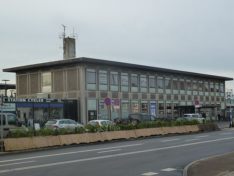
Photo: Dannebrog Spy, CC BY-SA 3.0.
Holbæk railway station is the main railway station serving the town of Holbæk in northwestern Zealand, Denmark. Holbæk station is located on the main line Northwest Line from Roskilde to Kalundborg and is the southern terminus of the Odsherredsbanen branch line from Holbæk to Nykøbing Sjælland. Holbæk railway station is situated 2½ km northeast of Foderbrættet.
Kunsthøjskolen i Holbæk
School

Photo: Moeng, CC BY-SA 3.0.
Kunsthøjskolen i Holbæk is a school, which is situated 1¼ km east of Foderbrættet.
Holbæk Museum
Museum
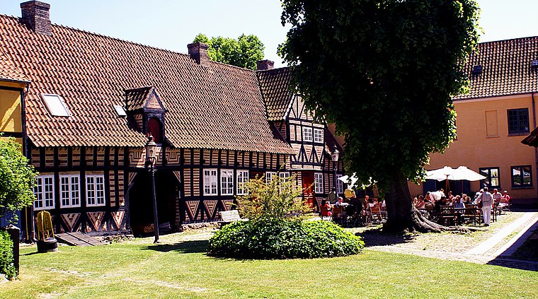
Photo: Moeng, CC BY-SA 3.0.
Holbæk Museum is a local history museum in Holbæk, Denmark. It is based in a large complex of historic, mostly half-timbered buildings from the 17th to 19th century surrounding a garden space. Holbæk Museum is situated 3 km northeast of Foderbrættet.
Places in the Area
Nearby places include Holbæk MegaCenter and Tuse.

Tuse
Village
Tuse is a village in Denmark, located about 5 km west of Holbæk. It has a population of 1,380. Tuse is located in Holbæk Municipality and therefore is part of the Zealand Region. Tuse is situated 3 km west of Foderbrættet.
Holbæk

Photo: Freeskydk, CC BY-SA 4.0.
Holbæk is a city in Zealand. Holbæk is an important harbour city and a commercial and cultural center for the area.
Foderbrættet
- Categories: building, kiosk, food, and restaurant
- Location: Holbæk Municipality, Region Zealand, Denmark, Nordic countries, Europe
- View on OpenStreetMap
Latitude
55.70483° or 55° 42′ 17″ northLongitude
11.6692° or 11° 40′ 9″ eastOperator
Foderbrættet v/ Jesper Friis LundeOpen location code
9F7HPM39+WMOpenStreetMap ID
way 1436888733OpenStreetMap feature
amenity=fast_foodOpenStreetMap feature
building=kioskOpenStreetMap attribute
cuisine=hot_dogOpenStreetMap attribute
cuisine=burgerOpenStreetMap attribute
cuisine=sausage
This page is based on OpenStreetMap, Wikidata, and Wikimedia Commons.
We’d love your help improving our open data sources. Thank you for contributing.
Satellite Map
Discover Foderbrættet from above in high-definition satellite imagery.
Places with the Same Name
Discover other places named “Foderbrættet”.
Notable Places Nearby
Highlights include Højen and Library of the Scandinavian Branch Office of Jehovah’s Witnesses.
Nearby Places
Explore places such as Bauhaus and jem & fix.
Denmark: Must-Visit Destinations
Delve into Copenhagen, Aarhus, Odense, and Aalborg.
Curious Fast Food Restaurants to Discover
Uncover intriguing fast food restaurants from every corner of the globe.
About Mapcarta. Data © OpenStreetMap contributors and available under the Open Database License". Text is available under the CC BY-SA 4.0 license, except for photos, directions, and the map. Photo: Inkey, CC BY 2.0.