Rückhalte- und Versickerungsbecken
Rückhalte- und Versickerungsbecken is in Willich, Viersen, North Rhine-Westphalia. Rückhalte- und Versickerungsbecken is situated nearby to the reservoir Regenwasserklärbecken, as well as near the playground Weidenweg.| Tap on a place to explore it |
Places of Interest Nearby
Highlights include Schloss Neersen and Düsseldorf Mönchengladbach Airport.
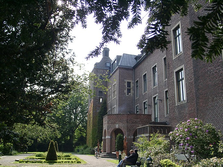
Schloss Neersen
Public building

Photo: Mino1997, CC BY-SA 4.0.
Schloss Neersen is a public building, which is situated 720 metres east of Rückhalte- und Versickerungsbecken.
Düsseldorf Mönchengladbach Airport
Aerodrome
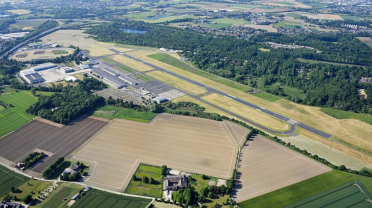
Photo: Carsten Steger, CC BY-SA 4.0.
Mönchengladbach Airport is a small regional airport located 4.4 km northeast of Mönchengladbach and 15.2 km west of Düsseldorf. It is co-owned by the company which also runs Düsseldorf Airport and the local utility company NVV AG. Düsseldorf Mönchengladbach Airport is situated 3 km southeast of Rückhalte- und Versickerungsbecken.
Kapelle Klein-Jerusalem
Church
 Kapelle Klein-Jerusalem is a church, which is situated 2 km northeast of Rückhalte- und Versickerungsbecken.
Places in the Area
Nearby places include Neersen and Vennheide.

Lockhütte
Neighborhood
 Lockhütte is a neighborhood, which is situated 3 km southwest of Rückhalte- und Versickerungsbecken.
Rückhalte- und Versickerungsbecken
- Type: Body of water
- Location: Willich, Viersen, Düsseldorf, North Rhine-Westphalia, Germany, Central Europe, Europe
- View on OpenStreetMap
Latitude
51.24972° or 51° 14′ 59″ northLongitude
6.46743° or 6° 28′ 3″ eastOpen location code
9F386FX8+VXOpenStreetMap ID
way 143751595OpenStreetMap feature
natural=water
This page is based on OpenStreetMap, Wikidata, and Wikimedia Commons.
We’d love your help improving our open data sources. Thank you for contributing.
Satellite Map
Discover Rückhalte- und Versickerungsbecken from above in high-definition satellite imagery.
Notable Places Nearby
Highlights include Regenwasserklärbecken and Weidenweg.
Nearby Places
Explore places such as Schneckenhebeanlage and Rückhalte- und Versickerungsbecken für Regenwasser am Bettrather Dyk.
North Rhine-Westphalia: Must-Visit Destinations
Delve into Cologne, Düsseldorf, Bonn, and Dortmund.
Curious Places to Discover
Uncover intriguing places from every corner of the globe.
About Mapcarta. Data © OpenStreetMap contributors and available under the Open Database License". Text is available under the CC BY-SA 4.0 license, except for photos, directions, and the map. Photo: Daniel Schwen, CC BY-SA 2.5.