Sondikako Haurreskola
Sondikako Haurreskola is a kindergarten in Erandio, Biscay, Basque Country. Sondikako Haurreskola is situated nearby to Lehendakari parkea, as well as near the library Biblioteca Pública.| Tap on a place to explore it |
Places of Interest Nearby
Highlights include Sondika station and Bilbao Airport.
Sondika station
Railway station
 Sondika is a railway station in Sondika, Basque Country, Spain. It is owned by Euskal Trenbide Sarea and operated by Euskotren. It lies on the Txorierri line. Sondika station is situated 230 metres east of Sondikako Haurreskola.
Bilbao Airport
Aerodrome
Bilbao Airport is a minor international airport located 9 km north of Bilbao, in the municipality of Loiu, in Biscay. It is the largest airport in the Basque Country and northern Spain, with 6,336,441 passengers in 2023.
Zangroiz station
Railway stop

Photo: Spotter LEVT, CC BY-SA 4.0.
Zangroiz is a railway station in Sondika, Basque Country, Spain. It is owned by Euskal Trenbide Sarea and operated by Euskotren. It lies on the Lutxana–Sondika line. Zangroiz station is situated 1 km west of Sondikako Haurreskola.
Places in the Area
Nearby places include Sondika and Loiu.
Sondika
Village
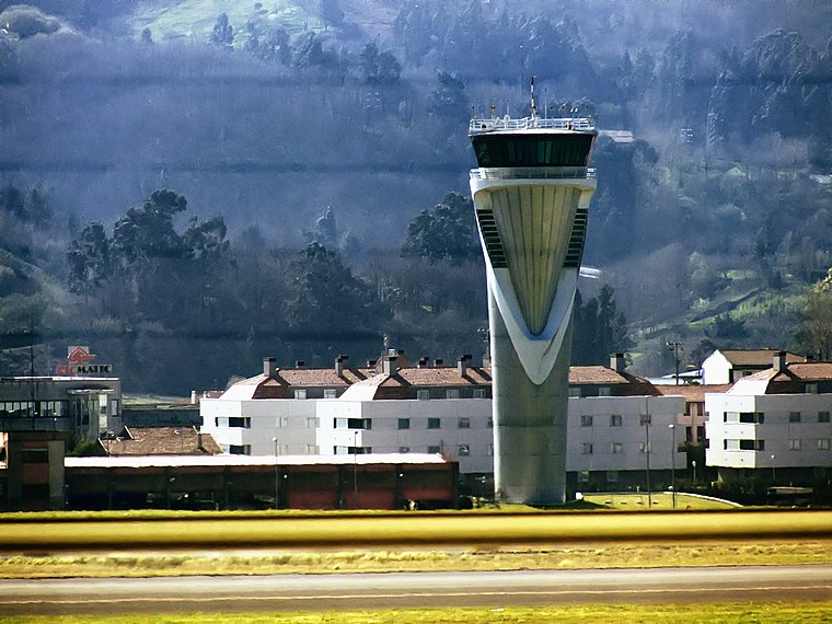
Photo: Andres Rueda, CC BY 2.0.
Sondika is a town and municipality located in the province of Biscay, in the Autonomous Community of Basque Country, northern Spain. Situated directly south of the runway of Bilbao Airport, it is the location of Bilbao British Cemetery, containing a Commonwealth War Graves Cemetery with 58 casualties.


Sondikako Haurreskola
- Type: Kindergarten
- Category: education
- Location: Erandio, Biscay, Basque Country, Northern Spain, Spain, Iberia, Europe
- View on OpenStreetMap
Latitude
43.29879° or 43° 17′ 56″ northLongitude
-2.931° or 2° 55′ 52″ westOpen location code
8CMV73X9+GJOpenStreetMap ID
way 1442798150OpenStreetMap feature
amenity=kindergarten
This page is based on OpenStreetMap, Wikidata, and Wikimedia Commons.
We’d love your help improving our open data sources. Thank you for contributing.
Satellite Map
Discover Sondikako Haurreskola from above in high-definition satellite imagery.
Notable Places Nearby
Highlights include Lehendakari parkea and Biblioteca Pública.
Nearby Places
Explore places such as Sondikako Batzokia and Sondikako terminala.
Basque Country: Must-Visit Destinations
Delve into Bilbao, San Sebastián, Vitoria-Gasteiz, and Guernica.
Curious Kindergartens to Discover
Uncover intriguing kindergartens from every corner of the globe.
About Mapcarta. Data © OpenStreetMap contributors and available under the Open Database License". Text is available under the CC BY-SA 4.0 license, except for photos, directions, and the map. Photo: Ander Abadia Zallo, CC BY 4.0.