Straßenmeisterei Mosbach
Straßenmeisterei Mosbach is a government office in Mosbach, Neckar-Odenwald-Kreis, Baden-Württemberg. Straßenmeisterei Mosbach is situated nearby to the health club Clever fit, as well as near Lady-Fitness-Kette.| Tap on a place to explore it |
Places of Interest Nearby
Highlights include Hallenbad Mosbach and St. Josef.
Hallenbad Mosbach
Sports venue
 Hallenbad Mosbach is a sports venue, which is situated 490 metres north of Straßenmeisterei Mosbach.
St. Josef
Church
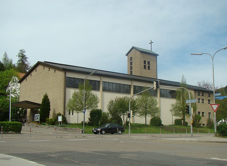
Photo: Schmelzle, CC BY-SA 3.0.
St. Josef is a church, which is situated 720 metres north of Straßenmeisterei Mosbach.
Mosbach Vocational School
School
 Mosbach Vocational School is situated 510 metres northeast of Straßenmeisterei Mosbach.
Places in the Area
Nearby places include Neckarelz and Diedesheim.
Neckarelz
Village

Photo: Schmelzle, CC BY-SA 3.0.
Neckarelz is a suburb of Mosbach in Baden-Württemberg, Germany.

Schreckhof
Hamlet

Photo: Wikimedia, CC BY-SA 3.0.
Schreckhof is a hamlet, which is situated 3 km northwest of Straßenmeisterei Mosbach.
Straßenmeisterei Mosbach
- Type: Government office
- Categories: office and government building
- Location: Mosbach, Neckar-Odenwald-Kreis, Karlsruhe Region, Baden-Württemberg, Germany, Central Europe, Europe
- View on OpenStreetMap
Latitude
49.34243° or 49° 20′ 33″ northLongitude
9.12813° or 9° 7′ 41″ eastOpen location code
8FXF84RH+X7OpenStreetMap ID
way 1446397749OpenStreetMap feature
office=government
This page is based on OpenStreetMap, Wikidata, and Wikimedia Commons.
We’d love your help improving our open data sources. Thank you for contributing.
Satellite Map
Discover Straßenmeisterei Mosbach from above in high-definition satellite imagery.
Notable Places Nearby
Highlights include Clever fit and Lady-Fitness-Kette.
Nearby Places
Explore places such as Neckarelz, Bama and Hestermann GmbH.
Baden-Württemberg: Must-Visit Destinations
Delve into Stuttgart, Heidelberg, Karlsruhe, and Mannheim.
Curious Government Offices to Discover
Uncover intriguing government offices from every corner of the globe.
About Mapcarta. Data © OpenStreetMap contributors and available under the Open Database License". Text is available under the CC BY-SA 4.0 license, except for photos, directions, and the map. Photo: Traveler100, CC BY-SA 3.0.