Cancha de Tizimín
Cancha de Tizimín is a park in Campeche, Yucatán and the South which is located on Calle 16. Cancha de Tizimín is situated nearby to the college ICATCAM, as well as near the park Cancha de Santa Clara.| Tap on a place to explore it |
Places in the Area
Nearby places include Seybaplaya.
Seybaplaya
Town
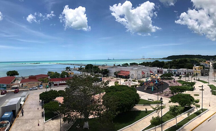 Seybaplaya is a city in the Mexican state of Campeche. It is located in the north of the state, 30 km from the state capital Campeche, Camp. It serves as the municipal seat of the municipality of the same name.
Cancha de Tizimín
- Type: Park
- Address: Calle 16, Barrio de Tizimín, Seybaplaya, Campeche 24460
- Category: recreation area
- Location: Campeche, Yucatán and the South, Mexico, North America
- View on OpenStreetMap
Latitude
19.64536° or 19° 38′ 43″ northLongitude
-90.68929° or 90° 41′ 22″ westOpen location code
76FFJ8W6+47OpenStreetMap ID
way 1446599411OpenStreetMap feature
leisure=park
This page is based on OpenStreetMap, Wikidata, and Wikimedia Commons.
We’d love your help improving our open data sources. Thank you for contributing.
Satellite Map
Discover Cancha de Tizimín from above in high-definition satellite imagery.
Notable Places Nearby
Highlights include ICATCAM and Cancha de Santa Clara.
Nearby Places
Explore places such as Escuela Primaria ‘Pablo García’ and Bodega Aurrera.
Campeche: Must-Visit Destinations
Delve into Campeche, Ciudad del Carmen, Champotón, and Edzna.
Curious Parks to Discover
Uncover intriguing parks from every corner of the globe.
About Mapcarta. Data © OpenStreetMap contributors and available under the Open Database License". Text is available under the CC BY-SA 4.0 license, except for photos, directions, and the map. Photo: Wikimedia, CC0.