Union PInes Apartments
Union PInes Apartments is a residential area in Bexar, Texas which is located on Pleasanton Road. Union PInes Apartments is situated nearby to Church of God of Prophecy, as well as near Harlandale High School.| Tap on a place to explore it |
Places of Interest Nearby
Highlights include Harlandale High School and Mission San José.
Harlandale High School
School
Harlandale High School is a public high school located in the city of San Antonio, Texas and classified as a 5A school by the University Interscholastic League. Harlandale High School is situated 1,400 feet east of Union PInes Apartments.
Mission San José
Church

Photo: Liveon001, CC BY-SA 3.0.
Mission San José y San Miguel de Aguayo is an historic Catholic mission in San Antonio, Texas, United States. The mission was named in part for the Marquis de San Miguel de Aguayo, José de Azlor y Virto de Vera. Mission San José is situated 1½ miles east of Union PInes Apartments.
South Park Mall
Shopping center
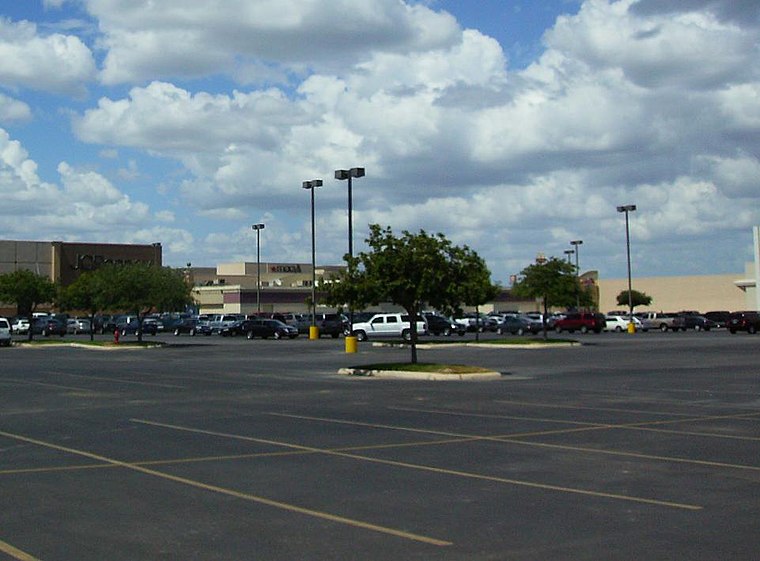
Photo: AMAPO, CC BY-SA 3.0.
South Park Mall is a shopping mall located on the southwest side of San Antonio, Texas. It serves the communities on the south side of the city, with a Hispanic theme inside it. South Park Mall is situated 1½ miles southwest of Union PInes Apartments.
Places in the Area
Nearby places include La Villita and Brooks City-Base.
La Villita
Neighborhood
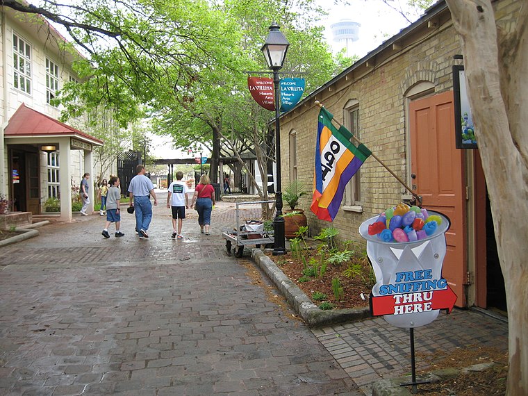
Photo: Johnpeter2008, Public domain.
La Villita Historic Arts Village is an art community in downtown San Antonio, Texas, United States. There are art galleries, stores selling souvenirs, gifts, custom jewelry, pottery, and imported Mexican folk art, as well as several restaurants in the district. La Villita is situated 4 miles north of Union PInes Apartments.
Brooks City-Base
Neighborhood
Brooks is a mixed-use development that was founded on the former Brooks Air Force Base when the United States Air Force closed the facility in 2002. Following the 1995 BRAC, when Brooks AFB was removed from the Base Realignment and Closure list, city, state… Brooks City-Base is situated 4 miles east of Union PInes Apartments.
San Antonio

Photo: 归零者, CC BY-SA 4.0.
San Antonio is the second largest city in the state of Texas and the 7th largest in the United States. It's the 24th largest metropolitan area in the country.
Union PInes Apartments
- Type: Residential area
- Address: 1707 Pleasanton Road, San Antonio, TX 78221
- Location: Bexar, Texas, United States, North America
- View on OpenStreetMap
Latitude
29.36531° or 29° 21′ 55″ northLongitude
-98.50632° or 98° 30′ 23″ westOpen location code
76X39F8V+4FOpenStreetMap ID
way 144859429OpenStreetMap feature
landuse=residential
This page is based on OpenStreetMap, Wikidata, and Wikimedia Commons.
We’d love your help improving our open data sources. Thank you for contributing.
Satellite Map
Discover Union PInes Apartments from above in high-definition satellite imagery.
Notable Places Nearby
Highlights include Church of God of Prophecy and Saved by Grace Gospel Church.
Nearby Places
Explore places such as McDonald’s and Mia Shop.
Texas: Must-Visit Destinations
Delve into Houston, Austin, Dallas, and San Antonio.
Curious Residential Areas to Discover
Uncover intriguing residential areas from every corner of the globe.
About Mapcarta. Data © OpenStreetMap contributors and available under the Open Database License". Text is available under the CC BY-SA 4.0 license, except for photos, directions, and the map. Photo: Wikimedia, CC0.