Playground Am Lenkert
Playground Am Lenkert is a playground in Bonn, Cologne District, North Rhine-Westphalia. Playground Am Lenkert is situated nearby to the park Schweinheimer Platz, as well as near the church Sebastianuskapelle.| Tap on a place to explore it |
Places of Interest Nearby
Highlights include Godesburg and Haus an der Redoute.
Godesburg

Photo: Dickbauch, CC BY-SA 3.0.
The Godesburg is a castle in Bad Godesberg, a formerly independent part of Bonn, Germany. Built in the early 13th century on the Godesberg, a hill of volcanic origin, it was largely destroyed following a siege in 1583 at the start of the Cologne War. Godesburg is situated 720 metres northeast of Playground Am Lenkert.
Haus an der Redoute
Arts center
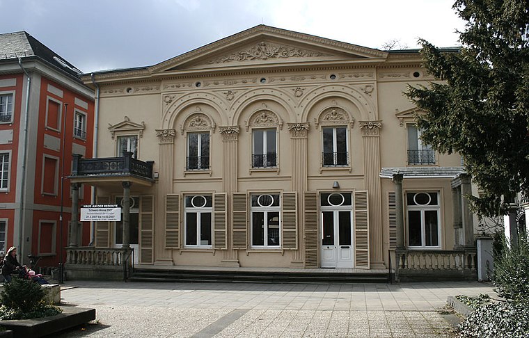
Photo: Sozi, Public domain.
Haus an der Redoute is an arts center, which is situated 730 metres east of Playground Am Lenkert.
Schauspielhaus Bad Godesberg
Theater building

Photo: Tilman2007, CC BY-SA 4.0.
The Schauspielhaus Bad Godesberg is the largest theatre in the city of Bonn and the first new theatre building in the Federal Republic of Germany in the post-war period. Schauspielhaus Bad Godesberg is situated 1 km east of Playground Am Lenkert.
Places in the Area
Nearby places include Bad Godesberg and Friesdorf.
Bad Godesberg
Suburb
Photo: Dickbauch, CC BY-SA 3.0.
Bad Godesberg is a borough of Bonn, southern North Rhine-Westphalia, Germany. From 1949 to 1999, while Bonn was the capital of the Federal Republic of Germany, most foreign embassies were in Bad Godesberg.
Friesdorf
Quarter

Photo: kaffeeeinstein, CC BY-SA 2.0.
Friesdorf is a quarter of city district Bad Godesberg, Bonn, Germany.
Hochkreuz
Quarter

Photo: Leit, Public domain.
Hochkreuz is a quarter, which is situated 2½ km north of Playground Am Lenkert.
Playground Am Lenkert
- Type: Playground
- Category: recreation area
- Location: Bonn, Cologne District, Cologne Lowland, North Rhine-Westphalia, Germany, Central Europe, Europe
- View on OpenStreetMap
Latitude
50.68112° or 50° 40′ 52″ northLongitude
7.14284° or 7° 8′ 34″ eastOperator
Stadt BonnOpen location code
9F29M4JV+C4OpenStreetMap ID
way 1448685829OpenStreetMap feature
leisure=playground
This page is based on OpenStreetMap, Wikidata, and Wikimedia Commons.
We’d love your help improving our open data sources. Thank you for contributing.
Satellite Map
Discover Playground Am Lenkert from above in high-definition satellite imagery.
In Other Languages
“Playground Am Lenkert” goes by many names.
- German: “Spielplatz Am Lenkert”
Notable Places Nearby
Highlights include Schweinheimer Platz and Brunnen Schweinheimer Platz.
Nearby Places
Explore places such as Schweineskulpturen and Öffentlicher Bücherschrank Schweinheimer Platz.
Cologne Lowland: Must-Visit Destinations
Delve into Cologne, Leverkusen, Siegburg, and Bad Honnef.
Curious Playgrounds to Discover
Uncover intriguing playgrounds from every corner of the globe.
About Mapcarta. Data © OpenStreetMap contributors and available under the Open Database License". Text is available under the CC BY-SA 4.0 license, except for photos, directions, and the map. Photo: Danapit, CC BY-SA 3.0.