Villa Muriel
Villa Muriel is a building in Toulon, Var, Provence-Alpes-Côte d’Azur. Villa Muriel is situated nearby to the mountain saddle Col de la Citerne, as well as near the town hall Mairie Annexe.| Tap on a place to explore it |
Places of Interest Nearby
Highlights include Mont Faron and Toulon Sainte-Musse.
Mont Faron
Peak
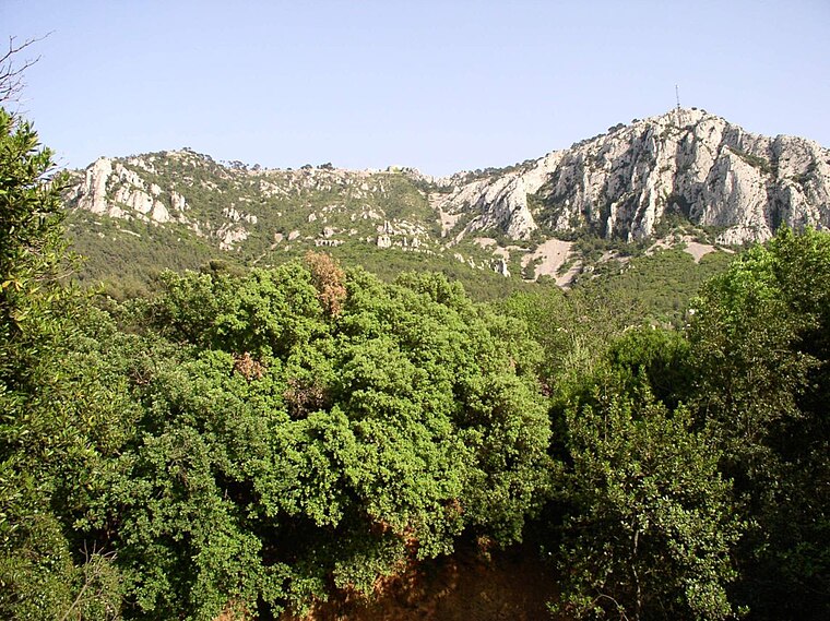
Photo: Wikimedia, CC BY-SA 1.0.
Mont Faron is a mountain overlooking the city and roadstead of Toulon, France. It is 584m high. At its peak is a memorial dedicated to the 1944 Allied landings in Provence, and to the liberation of Toulon.
Toulon Sainte-Musse
Railway station

Photo: PartageWiki, CC BY-SA 4.0.
Toulon Sainte-Musse is a railway station, which is situated 1½ km southeast of Villa Muriel.
Église de l’Immaculée-Conception de Siblas
Church

Photo: Mensart, CC BY-SA 4.0.
Église de l’Immaculée-Conception de Siblas is a church, which is situated 1½ km west of Villa Muriel.
Places in the Area
Nearby places include La Valette-du-Var and Basse Ville.
La Valette-du-Var
Town

Photo: Esby, CC BY-SA 3.0.
La Valette-du-Var is a commune in the Var department in the Provence-Alpes-Côte d'Azur region in Southeastern France.
Basse Ville
Suburb

Photo: SiefkinDR, Public domain.
Basse Ville is a suburb, which is situated 2½ km southwest of Villa Muriel.
Cap Brun
Suburb

Photo: Adltbc92, CC BY-SA 3.0.
Cap Brun is a suburb, which is situated 3 km south of Villa Muriel.
Villa Muriel
- Type: Building
- Location: Toulon, Arrondissement of Toulon, Var, Provence-Alpes-Côte d’Azur, France, Europe
- View on OpenStreetMap
Latitude
43.1343° or 43° 8′ 4″ northLongitude
5.96019° or 5° 57′ 37″ eastOpen location code
8FM74XM6+P3OpenStreetMap ID
way 145059388OpenStreetMap feature
building=yes
This page is based on OpenStreetMap, Wikidata, and Wikimedia Commons.
We’d love your help improving our open data sources. Thank you for contributing.
Satellite Map
Discover Villa Muriel from above in high-definition satellite imagery.
Places with the Same Name
Discover other places named “Villa Muriel”.
Notable Places Nearby
Highlights include Col de la Citerne and Mairie Annexe.
Nearby Places
Explore places such as Les Bougainvilliers and Les Delphiniums.
Var: Must-Visit Destinations
Delve into Saint-Tropez, Hyères, Fréjus, and Saint-Raphaël.
Curious Buildings to Discover
Uncover intriguing buildings from every corner of the globe.
About Mapcarta. Data © OpenStreetMap contributors and available under the Open Database License". Text is available under the CC BY-SA 4.0 license, except for photos, directions, and the map. Photo: yves Tennevin, CC BY 2.0.