Huron River Path Metropark
Huron River Path Metropark is a park in Huron Township, Erie, Ohio. Huron River Path Metropark is situated nearby to the hamlet Chaska Beach.| Tap on a place to explore it |
Places of Interest Nearby
Highlights include Christ Episcopal Church.
Christ Episcopal Church
Church

Photo: LeeG7144, CC BY-SA 3.0.
Christ Episcopal Church is a historic Episcopal church located at 120 Ohio Street in Huron, Ohio, in the United States. On March 4, 1975, it was added to the National Register of Historic Places. Christ Episcopal Church is situated 2½ miles north of Huron River Path Metropark.
Places in the Area
Nearby places include Huron and Chaska Beach.
Huron
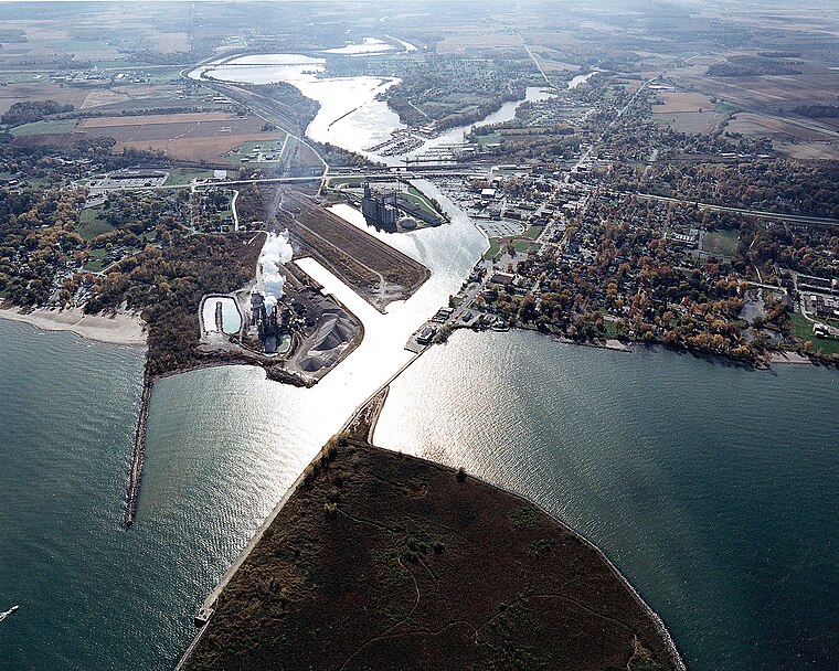
Photo: Wikimedia, Public domain.
Huron is a city of almost 7,000 people in Erie County on Ohio's North Coast along Lake Erie and on the banks of the Huron River.
Chaska Beach
Hamlet

Photo: Julrich1, Public domain.
Huron is a city in Erie County, Ohio, United States, located at the mouth of the Huron River on Lake Erie. The population was 6,922 at the 2020 census. It is part of the Sandusky micropolitan area. Chaska Beach is situated 2 miles north of Huron River Path Metropark.
Mitiwanga
Hamlet
Mitiwanga is an unincorporated community and census-designated place in Erie County, Ohio, United States. It is located within Berlin and Vermilion townships, on the south shore of Lake Erie. Mitiwanga is situated 4½ miles east of Huron River Path Metropark.
Huron River Path Metropark
- Type: Park
- Category: recreation area
- Location: Huron Township, Erie, Ohio, Midwest, United States, North America
- View on OpenStreetMap
Latitude
41.36258° or 41° 21′ 45″ northLongitude
-82.54883° or 82° 32′ 56″ westOpen location code
86HV9F72+2FOpenStreetMap ID
way 1450781620OpenStreetMap feature
leisure=park
This page is based on OpenStreetMap, Wikidata, and Wikimedia Commons.
We’d love your help improving our open data sources. Thank you for contributing.
Satellite Map
Discover Huron River Path Metropark from above in high-definition satellite imagery.
Notable Places Nearby
Highlights include Thunderbird South and McMillen Cemetery.
Nearby Places
Explore places such as Erie County Wastewater Plant and Shawnee Elementery School.
Ohio: Must-Visit Destinations
Delve into Columbus, Cincinnati, Cleveland, and Bowling Green.
Curious Parks to Discover
Uncover intriguing parks from every corner of the globe.
About Mapcarta. Data © OpenStreetMap contributors and available under the Open Database License". Text is available under the CC BY-SA 4.0 license, except for photos, directions, and the map. Photo: Wikimedia, CC0.