Zamrznuté oká
Zamrznuté oká is in Slovakia. Zamrznuté oká is situated nearby to the lake Zamrznuté pleso, as well as near the peak Velický štít.| Tap on a place to explore it |
Places of Interest Nearby
Highlights include Zamrznuté pleso and Gerlachovský štít.

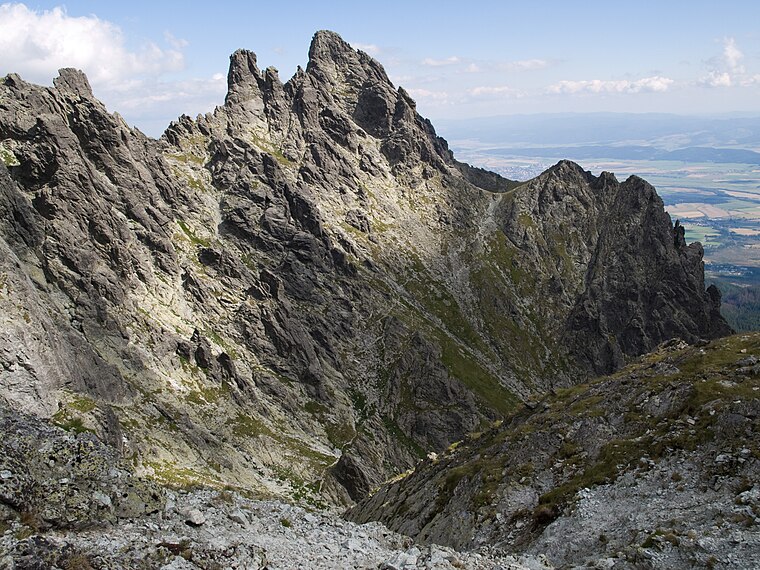
Gerlachovský štít
Peak

Photo: Kristo, CC BY-SA 3.0.
Gerlachovský štít, informally referred to as Gerlach, is the highest peak in the High Tatras, in Slovakia, and in the Carpathian Mountains. Its elevation is usually listed at 2654.4 m above sea level.

Places in the Area
Nearby places include Rovienky and Granátová stena.

Strelecké polia
Locality

Photo: Wikimedia, CC BY-SA 2.5.
Strelecké polia is a locality, which is situated 3½ km east of Zamrznuté oká.
Zamrznuté oká
- Type: Body of water
- Location: Slovakia, Central Europe, Europe
- View on OpenStreetMap
Latitude
49.1775° or 49° 10′ 39″ northLongitude
20.13732° or 20° 8′ 14″ eastOpen location code
8GX254HP+2WOpenStreetMap ID
way 1455590437OpenStreetMap feature
natural=water
This page is based on OpenStreetMap, Wikidata, and Wikimedia Commons.
We’d love your help improving our open data sources. Thank you for contributing.
Satellite Map
Discover Zamrznuté oká from above in high-definition satellite imagery.
Notable Places Nearby
Highlights include Divá veža and Poľský hrebeň.
Nearby Places
Explore places such as Zamrznuté oká and HZS.
Slovakia: Must-Visit Destinations
Delve into Bratislava, Košice, Banská Bystrica, and Trnava.
Curious Places to Discover
Uncover intriguing places from every corner of the globe.
About Mapcarta. Data © OpenStreetMap contributors and available under the Open Database License". Text is available under the CC BY-SA 4.0 license, except for photos, directions, and the map. Photo: Danapit, CC BY-SA 3.0.