Instituto de Educación Secundaria Europa
Instituto de Educación Secundaria Europa is a school in Águilas, Murcia, Murcia. Instituto de Educación Secundaria Europa is situated nearby to the public building Residencia de los ferroviarios, as well as near the park Paseo Víctimas del Terrorismo.| Tap on a place to explore it |
Places of Interest Nearby
Highlights include Train station of Águilas and Águilas Plaza.
Train station of Águilas
Railway station
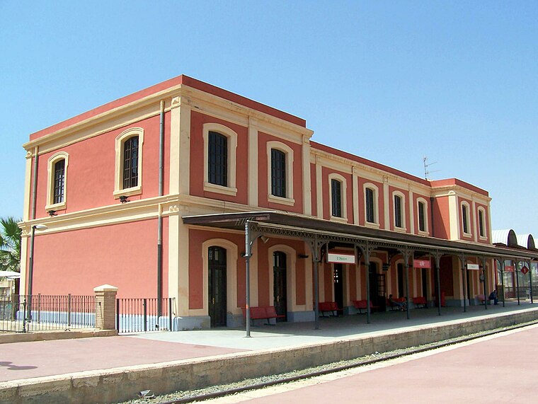
Photo: Wikimedia, CC BY-SA 3.0.
Train station of Águilas is a railway station, which is situated 420 metres south of Instituto de Educación Secundaria Europa.
Águilas Plaza
Shopping center

Photo: Panxitofeliz, CC BY 2.5 es.
Águilas Plaza is a shopping center, which is situated 1 km east of Instituto de Educación Secundaria Europa.
Castillo de San Juan de las Águilas

Photo: Wikimedia, CC BY-SA 2.0.
Castillo de San Juan de las Águilas is situated 1½ km south of Instituto de Educación Secundaria Europa.
Places in the Area
Nearby places include San Juan De Los Terreros.
San Juan De Los Terreros
Village

Photo: icetea1234567, CC BY-SA 3.0.
San Juan De Los Terreros is the easternmost village of Andalusia. The coastal village has several bays and beaches nearby. San Juan de los Terreros is a few miles along the coast south of Aguilas. San Juan De Los Terreros is situated 10 km southwest of Instituto de Educación Secundaria Europa.
Instituto de Educación Secundaria Europa
- Type: School
- Also known as: “IES Europa”
- Category: education
- Location: Águilas, Murcia, Murcia, Eastern Spain, Spain, Iberia, Europe
- View on OpenStreetMap
Latitude
37.41345° or 37° 24′ 48″ northLongitude
-1.57364° or 1° 34′ 25″ westOpen location code
8C9WCC7G+9GOpenStreetMap ID
way 146465817OpenStreetMap feature
amenity=school
This page is based on OpenStreetMap, Wikidata, and Wikimedia Commons.
We’d love your help improving our open data sources. Thank you for contributing.
Satellite Map
Discover Instituto de Educación Secundaria Europa from above in high-definition satellite imagery.
Places with the Same Name
Discover other places named “Instituto de Educación Secundaria Europa”.
Notable Places Nearby
Highlights include Residencia de los ferroviarios and Paseo Víctimas del Terrorismo.
Nearby Places
Explore places such as Super Huracán and Peñarrubia.
Murcia: Must-Visit Destinations
Delve into Cartagena, Lorca, Caravaca de la Cruz, and La Manga.
Curious Schools to Discover
Uncover intriguing schools from every corner of the globe.
About Mapcarta. Data © OpenStreetMap contributors and available under the Open Database License". Text is available under the CC BY-SA 4.0 license, except for photos, directions, and the map. Photo: Mromsan, CC BY-SA 4.0.