wetron
wetron is a building in Rosenheim, Upper Bavaria, Bavaria which is located on An der Mangfall. wetron is situated nearby to Börsen Museum, as well as near the bowling alley Inn Bowling.| Tap on a place to explore it |
Places of Interest Nearby
Highlights include Heimat- und Industriemuseum and Rosenkranzkönigin.
Heimat- und Industriemuseum
Museum
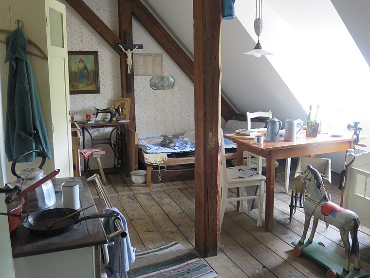
Photo: Edelmauswaldgeist, CC0.
Heimat- und Industriemuseum is situated 1½ km northwest of wetron.
Rosenkranzkönigin
Church

Photo: Renardo la vulpo, CC BY-SA 4.0.
Rosenkranzkönigin is a church, which is situated 1¼ km northeast of wetron.
St. Quirin
Church

Photo: Renardo la vulpo, CC BY-SA 4.0.
St. Quirin is a church, which is situated 1½ km northeast of wetron.
Places in the Area
Nearby places include Kolbermoor and Pang.
Kolbermoor
Town

Photo: Rufus46, CC BY-SA 3.0.
Kolbermoor is a town in the district of Rosenheim, in Bavaria, Germany. It is situated 5 km west of Rosenheim on the river Mangfall. In 1859 Kolbermoor railway stop was built for the new Bavarian Maximilian's Railway.

Aising
Suburb

Photo: Rufus46, CC BY-SA 3.0.
Aising is a suburb, which is situated 2½ km southeast of wetron.
wetron
- Type: Building
- Address: An der Mangfall 5, Rosenheim, 83026
- Location: Rosenheim, Upper Bavaria, Bavaria, Germany, Central Europe, Europe
- View on OpenStreetMap
Latitude
47.84504° or 47° 50′ 42″ northLongitude
12.08562° or 12° 5′ 8″ eastOpen location code
8FVJR3WP+26OpenStreetMap ID
way 150555837OpenStreetMap feature
building=yes
This page is based on OpenStreetMap, Wikidata, and Wikimedia Commons.
We’d love your help improving our open data sources. Thank you for contributing.
Satellite Map
Discover wetron from above in high-definition satellite imagery.
Notable Places Nearby
Highlights include Börsen Museum and Inn Bowling.
Nearby Places
Explore places such as Börsenverlag and Naturstein Hauser.
Upper Bavaria: Must-Visit Destinations
Delve into Munich, Ingolstadt, Dachau, and Garmisch-Partenkirchen.
Curious Buildings to Discover
Uncover intriguing buildings from every corner of the globe.
About Mapcarta. Data © OpenStreetMap contributors and available under the Open Database License". Text is available under the CC BY-SA 4.0 license, except for photos, directions, and the map. Photo: Helmlechner, CC BY-SA 4.0.