Centre de secours
Centre de secours is a fire station in Darney, Arrondissement of Neufchâteau, Grand Est. Centre de secours is situated nearby to the museum Centre d’animation de la préhistoire, as well as near the sports venue Les Récollets.| Tap on a place to explore it |
Places of Interest Nearby
Highlights include Église Sainte-Madeleine and Église Saint-Epvre de Bonvillet.
Église Sainte-Madeleine
Church

Photo: Wikimedia, CC BY-SA 3.0.
Église Sainte-Madeleine is a church, which is situated 460 metres south of Centre de secours.
Église Saint-Epvre de Bonvillet
Church

Photo: Rauenstein, CC BY-SA 3.0.
Église Saint-Epvre de Bonvillet is a church, which is situated 1¼ km northeast of Centre de secours.
Église Saints-Faust-et-Jovin de Belmont-lès-Darney
Church
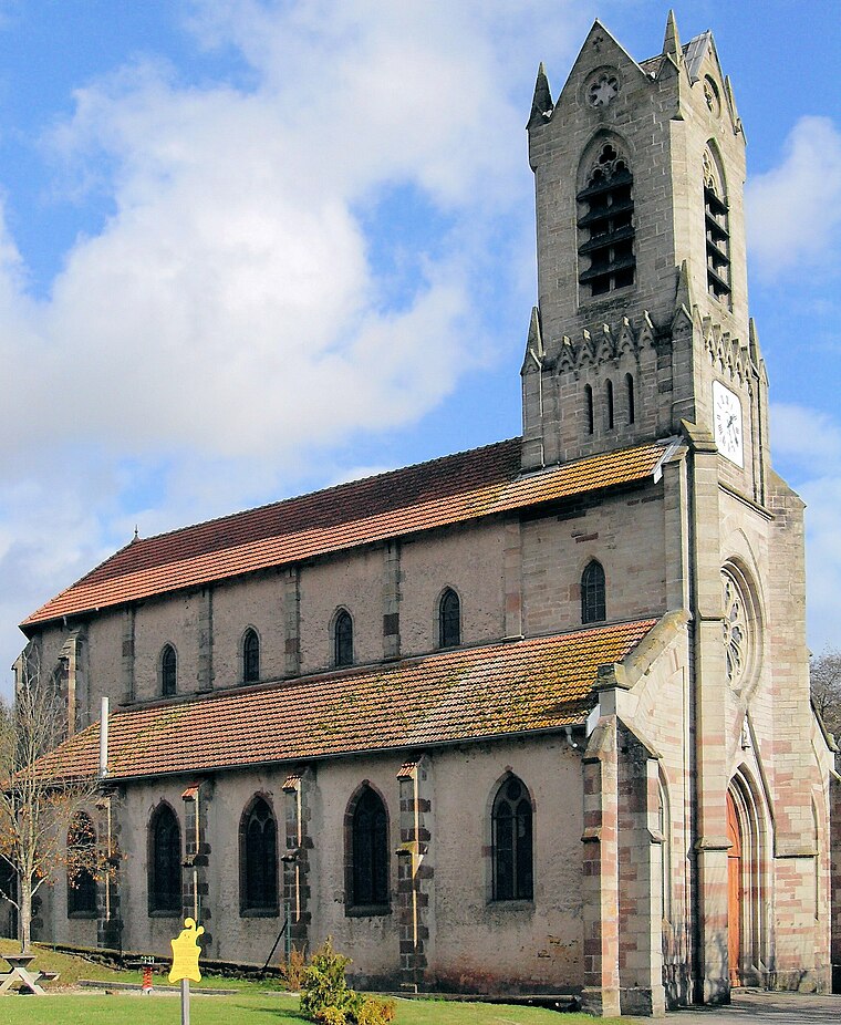
Photo: Rauenstein, CC BY-SA 3.0.
Église Saints-Faust-et-Jovin de Belmont-lès-Darney is a church, which is situated 2½ km west of Centre de secours.
Places in the Area
Nearby places include Darney and Bonvillet.
Darney
Village

Photo: Rauenstein, CC BY-SA 3.0.
Darney is a commune in the Vosges department in Grand Est in northeastern France. It is located in the Vôge Plateau, around the location of the source of the river Saône. Darney is known for its forest of oak and beech trees.
Bonvillet
Village
Photo: Rauenstein, CC BY-SA 3.0.
Bonvillet is a commune in the Vosges department in Grand Est in north-eastern France.
Belmont-lès-Darney
Village
Photo: Rauenstein, CC BY-SA 3.0.
Belmont-lès-Darney is a commune in the Vosges department in Grand Est in northeastern France. Its inhabitants are called Belmontais in French. Belmont-lès-Darney is situated 2½ km west of Centre de secours.
Centre de secours
- Type: Fire station
- Category: building
- Location: Darney, Arrondissement of Neufchâteau, Vosges, Grand Est, France, Europe
- View on OpenStreetMap
Latitude
48.08979° or 48° 5′ 23″ northLongitude
6.04559° or 6° 2′ 44″ eastOpen location code
8FW832QW+W6OpenStreetMap ID
way 152414274OpenStreetMap feature
amenity=fire_stationOpenStreetMap feature
building=yes
This page is based on OpenStreetMap, Wikidata, and Wikimedia Commons.
We’d love your help improving our open data sources. Thank you for contributing.
Satellite Map
Discover Centre de secours from above in high-definition satellite imagery.
Places with the Same Name
Discover other places named “Centre de secours”.
Notable Places Nearby
Highlights include Centre d’animation de la préhistoire and Les Récollets.
Nearby Places
Explore places such as L’Amusé du pain and La Friperie d’Emilie.
Grand Est: Must-Visit Destinations
Delve into Strasbourg, Reims, Metz, and Nancy.
Curious Fire Stations to Discover
Uncover intriguing fire stations from every corner of the globe.
About Mapcarta. Data © OpenStreetMap contributors and available under the Open Database License". Text is available under the CC BY-SA 4.0 license, except for photos, directions, and the map. Photo: Florival fr, CC BY-SA 3.0.