Colegio Emilio Candel
Colegio Emilio Candel is a school in Archena, Murcia, Murcia. Colegio Emilio Candel is situated nearby to the recreation area Parque de la Iglesia, as well as near the church Iglesia de San Juan Bautista.| Tap on a place to explore it |
Places in the Area
Nearby places include Villanueva del Río Segura and Ulea.
Villanueva del Río Segura
Village

Photo: Lionni, Public domain.
Villanueva del Río Segura is a municipality in the Region of Murcia, Spain. Villanueva del Río Segura is situated 3½ km northwest of Colegio Emilio Candel.
Ulea
Village
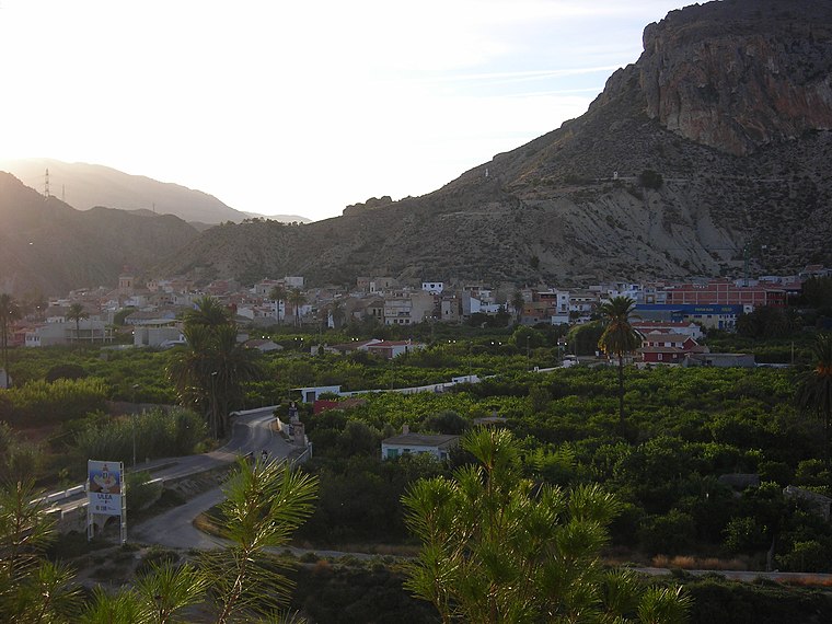
Photo: Sebasgs, CC BY-SA 4.0.
Ulea is a Spanish municipality in the autonomous community of Murcia. It has a population of 991 and an area of 40 km2. Ulea is situated 4 km northwest of Colegio Emilio Candel.
Ceutí
Town

Photo: Ceutiense1, CC BY-SA 4.0.
Ceutí is a municipality in the autonomous region of Murcia in southeastern Spain and is located in the south-east of the northeasternquarter of the Region. As of 2021, there are 12,199 inhabitants. Ceutí is situated 4½ km southeast of Colegio Emilio Candel.
Colegio Emilio Candel
- Type: School
- Category: education
- Location: Archena, Murcia, Murcia, Eastern Spain, Spain, Iberia, Europe
- View on OpenStreetMap
Latitude
38.11156° or 38° 6′ 42″ northLongitude
-1.2988° or 1° 17′ 56″ westOpen location code
8CCW4P62+JFOpenStreetMap ID
way 153469053OpenStreetMap feature
amenity=school
This page is based on OpenStreetMap, Wikidata, and Wikimedia Commons.
We’d love your help improving our open data sources. Thank you for contributing.
Satellite Map
Discover Colegio Emilio Candel from above in high-definition satellite imagery.
Notable Places Nearby
Highlights include Parque de la Iglesia and Iglesia de San Juan Bautista.
Nearby Places
Explore places such as Embutidos y Jamones Esteban El Cigarrero and Plaza de Abastos.
Murcia: Must-Visit Destinations
Delve into Cartagena, Lorca, Caravaca de la Cruz, and La Manga.
Curious Schools to Discover
Uncover intriguing schools from every corner of the globe.
About Mapcarta. Data © OpenStreetMap contributors and available under the Open Database License". Text is available under the CC BY-SA 4.0 license, except for photos, directions, and the map. Photo: Tango7174, CC BY-SA 4.0.