Escolinha Canicultura Agrária
Escolinha Canicultura Agrária is a recreation area in Coimbra District, Portugal. Escolinha Canicultura Agrária is situated nearby to the pitch Campo de Rugby da Escola Agrária de Coimbra - IPC, as well as near the ruins Quinta de Santo António.| Tap on a place to explore it |
Places of Interest Nearby
Highlights include Choupal National Forest and Coimbra-Cidade train station.
Choupal National Forest
Park
Choupal National Forest is a national forest in Coimbra, Portugal. It is a short distance from the city downtown and runs alongside the Mondego River. The forest has trails for jogging, walking, cycling and horse-riding. Choupal National Forest is situated 1 km northwest of Escolinha Canicultura Agrária.
Coimbra-Cidade train station
Railway station
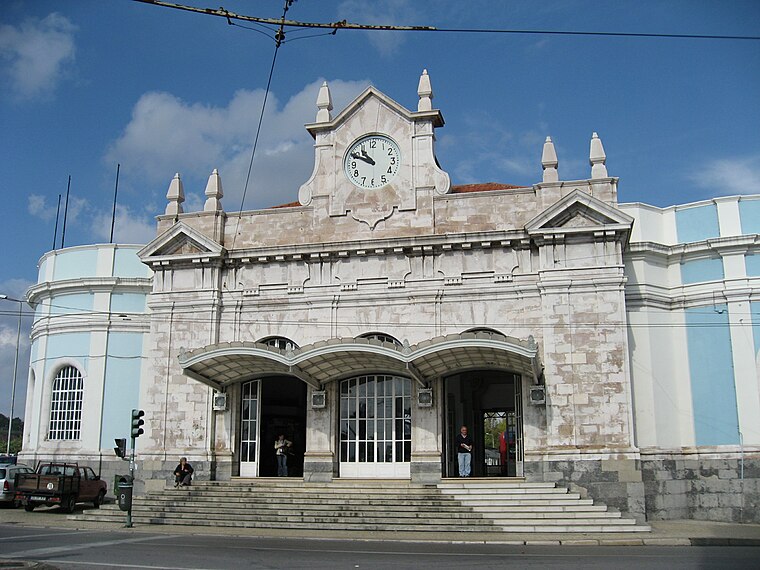
Photo: AlanFord, Public domain.
Coimbra-Cidade train station is a railway station, which is situated 1½ km east of Escolinha Canicultura Agrária.
Bencanta halt
Railway stop

Photo: 69joehawkins, CC BY-SA 4.0.
Bencanta halt is a railway stop, which is situated 650 metres west of Escolinha Canicultura Agrária.
Places in the Area
Nearby places include São Martinho do Bispo and Santa Clara.
São Martinho do Bispo
Suburb
São Martinho do Bispo is a former civil parish in the municipality of Coimbra, Portugal. The population in 2011 was 14,147, in an area of 16.96 km2. On 28 January 2013 it merged with Ribeira de Frades to form São Martinho do Bispo e Ribeira de Frades.
Santa Clara
Suburb
Santa Clara is a former civil parish in the municipality of Coimbra, Portugal. It was also known as São Francisco or São Francisco da Ponte after its foundation in 1855.
Coimbra

Photo: Alvesgaspar, CC BY-SA 3.0.
Coimbra is the traditional capital city of Central Portugal's historic Beira Litoral region. With over 140,000 inhabitants, it is the largest municipality there and one of Portugal's four largest metropolises.
Escolinha Canicultura Agrária
- Type: Recreation area
- Categories: tourist attraction and tourism
- Location: Coimbra District, Portugal, Iberia, Europe
- View on OpenStreetMap
Latitude
40.21376° or 40° 12′ 50″ northLongitude
-8.44851° or 8° 26′ 55″ westOpen location code
8CGH6H72+GHOpenStreetMap ID
way 154995059OpenStreetMap feature
landuse=recreation_ground
This page is based on OpenStreetMap, Wikidata, and Wikimedia Commons.
We’d love your help improving our open data sources. Thank you for contributing.
Satellite Map
Discover Escolinha Canicultura Agrária from above in high-definition satellite imagery.
Notable Places Nearby
Highlights include Campo de Rugby da Escola Agrária de Coimbra - IPC and Quinta de Santo António.
Nearby Places
Explore places such as Vale Gemil and Vale Gemil.
Portugal: Must-Visit Destinations
Delve into Lisbon, Caldas da Rainha, Porto, and Coimbra.
Curious Recreation Areas to Discover
Uncover intriguing recreation areas from every corner of the globe.
About Mapcarta. Data © OpenStreetMap contributors and available under the Open Database License". Text is available under the CC BY-SA 4.0 license, except for photos, directions, and the map. Photo: Alvesgaspar, CC BY-SA 3.0.