Glorieta Careintra
Glorieta Careintra is a garden in Guadalajara, Jalisco. Glorieta Careintra is situated nearby to the university Centro De Investigaciones Y Estudios Superiores En Antropologia Social, as well as near the recreation area Glorieta Pila Moderna.| Tap on a place to explore it |
Places of Interest Nearby
Highlights include Washington and Mexicaltzingo light rail station.
Washington
Railway stop

Photo: Elmerhomerochombo, CC BY-SA 4.0.
Washington is a railway stop, which is situated 230 metres southeast of Glorieta Careintra.
Mexicaltzingo light rail station
Railway stop
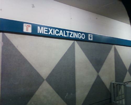
Photo: Qk-racho, CC BY-SA 3.0.
The Mexicaltzingo railway station is part of the Sistema de Tren Eléctrico Urbano in the Mexican state of Jalisco. Mexicaltzingo light rail station is situated 590 metres northeast of Glorieta Careintra.
Diana Theatre
Theater building

Photo: PrensaTeatroDiana, CC BY-SA 4.0.
The "Diana Theatre" is a 2,345-seat indoor theater in Guadalajara, Mexico. Diana Theatre is situated 1 km east of Glorieta Careintra.
Glorieta Careintra
- Type: Garden
- Category: recreation area
- Location: Guadalajara, Jalisco, Pacific Coast, Mexico, North America
- View on OpenStreetMap
Latitude
20.66275° or 20° 39′ 46″ northLongitude
-103.35882° or 103° 21′ 32″ westOpen location code
75GRMJ7R+3FOpenStreetMap ID
way 155368412OpenStreetMap feature
leisure=garden
This page is based on OpenStreetMap, Wikidata, and Wikimedia Commons.
We’d love your help improving our open data sources. Thank you for contributing.
Satellite Map
Discover Glorieta Careintra from above in high-definition satellite imagery.
Notable Places Nearby
Highlights include Centro De Investigaciones Y Estudios Superiores En Antropologia Social and Glorieta Pila Moderna.
Nearby Places
Explore places such as DESPACHO JURIDICO JOSE and TELEVISA.
Jalisco: Must-Visit Destinations
Delve into Puerto Vallarta, Tequila, Tepatitlan, and Lagos de Moreno.
Curious Gardens to Discover
Uncover intriguing gardens from every corner of the globe.
About Mapcarta. Data © OpenStreetMap contributors and available under the Open Database License". Text is available under the CC BY-SA 4.0 license, except for photos, directions, and the map. Photo: Wikimedia, CC0.