Terrain de Hand à 4
Terrain de Hand à 4 is a pitch in Vatan, Arrondissement of Issoudun, Centre-Val de Loire. Terrain de Hand à 4 is situated nearby to the pitch Terrains de Tennis 2, as well as near the sports venue Gymnase Inter Communal.| Tap on a place to explore it |
Places of Interest Nearby
Highlights include Église Saint-Laurian de Vatan.
Église Saint-Laurian de Vatan
Church

Photo: Wikimedia, CC BY-SA 3.0.
Église Saint-Laurian de Vatan is a church, which is situated 320 metres northeast of Terrain de Hand à 4.
Places in the Area
Nearby places include Vatan and Saint-Florentin.
Vatan
Village
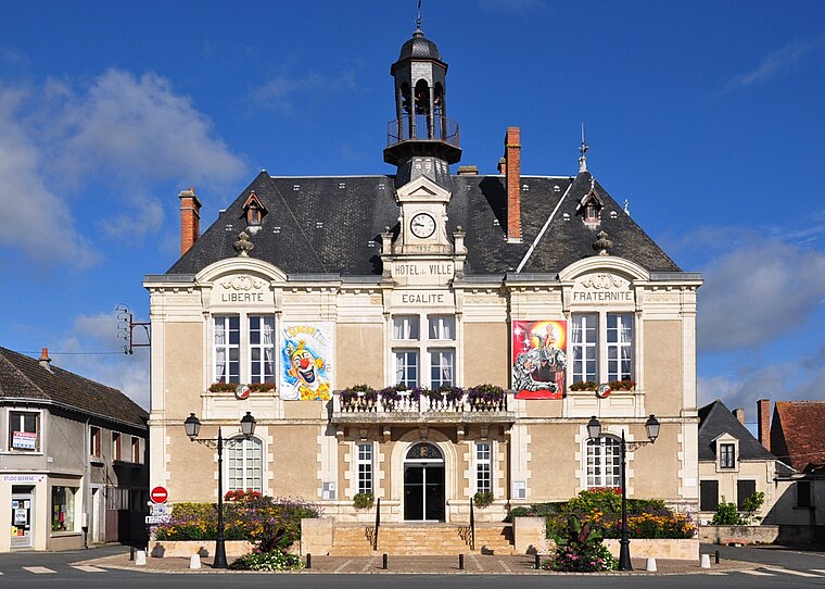
Photo: Wikimedia, CC BY-SA 3.0.
Vatan is a French commune in the Indre department in Centre-Val de Loire region. The town has been labeled Village étape since 1997 and Ville fleurie with 2 flowers.
La Chapelle-Saint-Laurian
Village

Photo: Eurasia21eu, CC BY-SA 3.0.
La Chapelle-Saint-Laurian is a commune in the Indre department in central France.
Terrain de Hand à 4
- Type: Pitch
- Categories: handball, recreation area, and sports location
- Location: Vatan, Arrondissement of Issoudun, Indre, Centre-Val de Loire, France, Europe
- View on OpenStreetMap
Latitude
47.07242° or 47° 4′ 21″ northLongitude
1.80719° or 1° 48′ 26″ eastOpen location code
8FV33RC4+XVOpenStreetMap ID
way 155879157OpenStreetMap feature
leisure=pitchOpenStreetMap feature
sport=handball
This page is based on OpenStreetMap, Wikidata, and Wikimedia Commons.
We’d love your help improving our open data sources. Thank you for contributing.
Satellite Map
Discover Terrain de Hand à 4 from above in high-definition satellite imagery.
Notable Places Nearby
Highlights include Terrains de Tennis 2 and Gymnase Inter Communal.
Nearby Places
Explore places such as Collège Ferdinand de Lesseps and La pizz’a Jack.
Centre-Val de Loire: Must-Visit Destinations
Delve into Orléans, Tours, Chartres, and Bourges.
Curious Pitches to Discover
Uncover intriguing pitches from every corner of the globe.
About Mapcarta. Data © OpenStreetMap contributors and available under the Open Database License". Text is available under the CC BY-SA 4.0 license, except for photos, directions, and the map. Photo: JLPC, CC BY-SA 3.0.