Étang Batardeau
Étang Batardeau is a pond in Loiret, Centre-Val de Loire. Étang Batardeau is situated nearby to the pond Étang Ribault, as well as near Étang Neuf.| Tap on a place to explore it |
Places of Interest Nearby
Highlights include Château de Pully.
Château de Pully
Castle

Photo: Wikimedia, Public domain.
Château de Pully is a castle, which is situated 1½ km west of Étang Batardeau.
Places in the Area
Nearby places include Jouy-le-Potier and Ligny-le-Ribault.
Jouy-le-Potier
Village

Photo: Wikimedia, Public domain.
Jouy-le-Potier is a commune in the Loiret department in north-central France. Jouy-le-Potier is situated 4 km northeast of Étang Batardeau.
Ligny-le-Ribault
Village
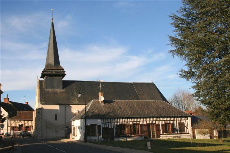
Photo: Vincent4145, CC BY-SA 3.0.
Ligny-le-Ribault is a commune in the Loiret department in north-central France. Ligny-le-Ribault is situated 5 km south of Étang Batardeau.
Dry
Village

Photo: Havang(nl), CC0.
Dry is a commune in the Loiret department in north-central France. Dry is situated 9 km northwest of Étang Batardeau.
Étang Batardeau
- Type: Pond
- Category: body of water
- Location: Loiret, Centre-Val de Loire, France, Europe
- View on OpenStreetMap
Latitude
47.7279° or 47° 43′ 40″ northLongitude
1.76384° or 1° 45′ 50″ eastOpen location code
8FV3PQH7+5GOpenStreetMap ID
way 157434403OpenStreetMap feature
natural=waterOpenStreetMap feature
water=pond
This page is based on OpenStreetMap, Wikidata, and Wikimedia Commons.
We’d love your help improving our open data sources. Thank you for contributing.
Satellite Map
Discover Étang Batardeau from above in high-definition satellite imagery.
Places with the Same Name
Discover other places named “Étang Batardeau”.
Notable Places Nearby
Highlights include Étang Ribault and Étang Neuf.
Nearby Places
Explore places such as Le Petit Pordet and Komatsu.
Centre-Val de Loire: Must-Visit Destinations
Delve into Orléans, Tours, Chartres, and Bourges.
Curious Ponds to Discover
Uncover intriguing ponds from every corner of the globe.
About Mapcarta. Data © OpenStreetMap contributors and available under the Open Database License". Text is available under the CC BY-SA 4.0 license, except for photos, directions, and the map. Photo: PMRMaeyaert, CC BY-SA 3.0.