Stade Blayais Rugby Haute Gironde
Stade Blayais Rugby Haute Gironde is a sports venue in Blaye, Gironde, Nouvelle-Aquitaine. Stade Blayais Rugby Haute Gironde is situated nearby to the fire station Centre d’incendie et de secours de Blaye, as well as near the sports venue Tennis Club Blaye Stade.| Tap on a place to explore it |
Places of Interest Nearby
Highlights include Cidadel of Blaye and Château des Rudel.
Cidadel of Blaye
Castle
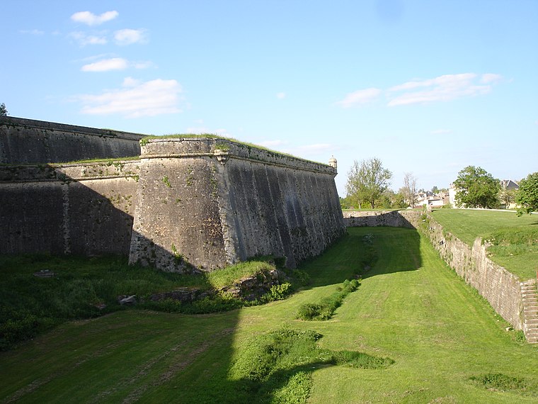
Photo: Pinpin, CC BY-SA 3.0.
Cidadel of Blaye is a castle, which is situated 530 metres south of Stade Blayais Rugby Haute Gironde.
Château des Rudel
Castle

Photo: Pinpin, CC BY-SA 3.0.
The Château des Rudel is a château in Blaye, Gironde, Nouvelle-Aquitaine, France. Château des Rudel is situated 420 metres south of Stade Blayais Rugby Haute Gironde.
Église Saint-Romain de Blaye
Church

Photo: Jpcuvelier, CC BY-SA 4.0.
Église Saint-Romain de Blaye is a church, which is situated 630 metres southeast of Stade Blayais Rugby Haute Gironde.
Places in the Area
Nearby places include Blaye and Saint-Ciers-de-Canesse.
Blaye
Town

Photo: Franck-fnba, CC BY-SA 4.0.
Blaye is a commune and subprefecture in the Gironde department in Nouvelle-Aquitaine in southwestern France. For centuries, Blaye was a particularly convenient crossing point for those who came from the north and went to Bordeaux or further south, to Spain and Portugal.
Saint-Ciers-de-Canesse
Village

Photo: Jack ma, CC BY-SA 3.0.
Saint-Ciers-de-Canesse is a commune in the Gironde department in Nouvelle-Aquitaine in southwestern France. Saint-Ciers-de-Canesse is situated 7 km southeast of Stade Blayais Rugby Haute Gironde.
Arcins
Village

Photo: Erdrokan, CC BY-SA 3.0.
Arcins is a commune in the Gironde department in southwestern France. Arcins is situated 8 km southwest of Stade Blayais Rugby Haute Gironde.
Stade Blayais Rugby Haute Gironde
- Type: Sports venue
- Categories: recreation area and sports location
- Location: Blaye, Arrondissement of Blaye, Gironde, Nouvelle-Aquitaine, France, Europe
- View on OpenStreetMap
Latitude
45.13386° or 45° 8′ 2″ northLongitude
-0.66505° or 0° 39′ 54″ westOpen location code
8CQX48MM+GXOpenStreetMap ID
way 159223828OpenStreetMap feature
leisure=sports_centre
This page is based on OpenStreetMap, Wikidata, and Wikimedia Commons.
We’d love your help improving our open data sources. Thank you for contributing.
Satellite Map
Discover Stade Blayais Rugby Haute Gironde from above in high-definition satellite imagery.
Notable Places Nearby
Highlights include Centre d’incendie et de secours de Blaye and Tennis Club Blaye Stade.
Nearby Places
Explore places such as Parking de La Citadelle and Parking République.
Gironde: Must-Visit Destinations
Delve into Bordeaux, Arcachon, Saint-Émilion, and Soulac-sur-Mer.
Curious Sports Venues to Discover
Uncover intriguing sports venues from every corner of the globe.
About Mapcarta. Data © OpenStreetMap contributors and available under the Open Database License". Text is available under the CC BY-SA 4.0 license, except for photos, directions, and the map. Photo: JLPC, CC BY-SA 3.0.