Abrißgebiet / Neuerschließung
Abrißgebiet / Neuerschließung is in Osternienburger Land, Anhalt-Bitterfeld, Saxony-Anhalt. Abrißgebiet / Neuerschließung is situated nearby to the playground Dorfspielplatz, as well as near the fire station Freiwillige Feuerwehr Osternienburg.| Tap on a place to explore it |
Places of Interest Nearby
Highlights include Osternienburg station and Völkerschlachtdenkmal.
Osternienburg station
Railway stop

Photo: Jwaller, CC BY-SA 3.0.
Osternienburg station was a railway station in the municipality of Osternienburg, located in the Anhalt-Bitterfeld district in Saxony-Anhalt, Germany. It was closed with the December 2022 timetable change because of low ridership. Osternienburg station is situated 1¼ km south of Abrißgebiet / Neuerschließung.
Völkerschlachtdenkmal
Memorial

Photo: Sicherlich, CC BY 2.5.
Völkerschlachtdenkmal is a memorial, which is situated 1¼ km west of Abrißgebiet / Neuerschließung.
Kirche Elsnigk
Church

Photo: Sicherlich, CC BY 3.0.
Kirche Elsnigk is a church, which is situated 2 km east of Abrißgebiet / Neuerschließung.
Places in the Area
Nearby places include Köthen and Aken.
Köthen

Photo: Sicherlich, CC BY 2.5.
Köthen is a small town in Saxony-Anhalt that was once the residence of the petty principality of Anhalt-Köthen.
Aken
Town
 Aken is a town in the district of Anhalt-Bitterfeld in Saxony-Anhalt, Germany. The town is located at the left bank of the river Elbe. Aken is situated 6 km north of Abrißgebiet / Neuerschließung.
Thurau
Hamlet
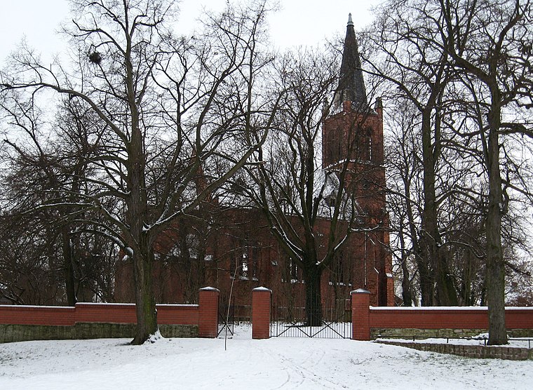
Photo: Sicherlich, CC BY 3.0.
Thurau is a hamlet, which is situated 7 km west of Abrißgebiet / Neuerschließung.
Abrißgebiet / Neuerschließung
- Type: Brownfield land
- Category: industry
- Location: Osternienburger Land, Anhalt-Bitterfeld, Saxony-Anhalt, Germany, Central Europe, Europe
- View on OpenStreetMap
Latitude
51.79347° or 51° 47′ 37″ northLongitude
12.02796° or 12° 1′ 41″ eastOpen location code
9F3JQ2VH+95OpenStreetMap ID
way 161567138OpenStreetMap feature
landuse=brownfield
This page is based on OpenStreetMap, Wikidata, and Wikimedia Commons.
We’d love your help improving our open data sources. Thank you for contributing.
Satellite Map
Discover Abrißgebiet / Neuerschließung from above in high-definition satellite imagery.
Notable Places Nearby
Highlights include Dorfspielplatz and Freiwillige Feuerwehr Osternienburg.
Nearby Places
Explore places such as Eiscafe Royal and Schmiede Behrendt.
Saxony-Anhalt: Must-Visit Destinations
Delve into Magdeburg, Halle, Wittenberg, and Quedlinburg.
Curious Places to Discover
Uncover intriguing places from every corner of the globe.
About Mapcarta. Data © OpenStreetMap contributors and available under the Open Database License". Text is available under the CC BY-SA 4.0 license, except for photos, directions, and the map. Photo: Sicherlich, CC BY 4.0.