Ehemaliges Impfzentrum West-Saarland
Ehemaliges Impfzentrum West-Saarland is a clinic in Saarlouis, Saarland. Ehemaliges Impfzentrum West-Saarland is situated nearby to the casino Empaya, as well as near the barracks Graf-Werder-Kaserne.| Tap on a place to explore it |
- Type: Clinic
- Address: Saarlouis, 66740
- Wheelchair access: yes
Places of Interest Nearby
Highlights include Saints Peter and Paul and Haus Ludwig.
Saints Peter and Paul
Church

Photo: LoKiLeCh, CC BY-SA 3.0.
Saints Peter and Paul is a church, which is situated 750 metres northwest of Ehemaliges Impfzentrum West-Saarland.
Haus Ludwig
Museum
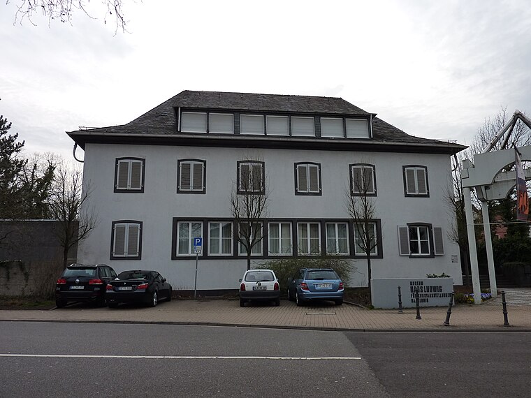
Photo: Xocolatl, Public domain.
Haus Ludwig, formerly Galerie Ludwig, is an art museum in Saarland, Germany. Haus Ludwig is situated 1¼ km east of Ehemaliges Impfzentrum West-Saarland.
Bastion 6 „Albrecht“
Castle

Photo: Z thomas, CC BY-SA 4.0.
Bastion 6 „Albrecht“ is a castle, which is situated 1 km east of Ehemaliges Impfzentrum West-Saarland.
Places in the Area
Nearby places include Beaumarais and Wallerfangen.

Wallerfangen
Village

Photo: Kolling, CC BY-SA 3.0.
Wallerfangen is a municipality of Saarlouis district, Saarland, Germany. Located west of Saarlouis and along the French border, it is the seat of the villages of Ittersdorf, Ihn, Leidingen, St.
Neuforweiler
Village

Photo: Kolling, CC BY-SA 3.0.
Neuforweiler is a village, which is situated 3 km south of Ehemaliges Impfzentrum West-Saarland.
Ehemaliges Impfzentrum West-Saarland
- Categories: health care, building, and industrial building
- Location: Saarlouis, Saarlouis, Saarland, Germany, Central Europe, Europe
- View on OpenStreetMap
Latitude
49.31285° or 49° 18′ 46″ northLongitude
6.73176° or 6° 43′ 54″ eastLevels
2Open location code
8FX88P7J+4POpenStreetMap ID
way 161636802OpenStreetMap feature
building=industrialOpenStreetMap feature
healthcare=centreOpenStreetMap attribute
wheelchair=yes
This page is based on OpenStreetMap, Wikidata, and Wikimedia Commons.
We’d love your help improving our open data sources. Thank you for contributing.
Satellite Map
Discover Ehemaliges Impfzentrum West-Saarland from above in high-definition satellite imagery.
Notable Places Nearby
Highlights include Empaya and Graf-Werder-Kaserne.
Nearby Places
Explore places such as Autohaus Klein & Kautenburger and Motorloft.
Saarland: Must-Visit Destinations
Delve into Saarbrücken, Homburg, Merzig, and Neunkirchen.
Curious Clinics to Discover
Uncover intriguing clinics from every corner of the globe.
About Mapcarta. Data © OpenStreetMap contributors and available under the Open Database License". Text is available under the CC BY-SA 4.0 license, except for photos, directions, and the map. Photo: wolfgangstaudt, CC BY 2.0.