Hotel am Stadtpark Ringhotel
Hotel am Stadtpark Ringhotel is a parking area in Lünen, Unna, North Rhine-Westphalia. Hotel am Stadtpark Ringhotel is situated nearby to the community center Hansesaal Lünen, as well as near Ringhotel Am Stadtpark.| Tap on a place to explore it |
- Type: Parking area
- Parking: surface
- Wheelchair access: yes
Places of Interest Nearby
Highlights include Heinz-Hilpert-Theater and Herz-Jesu-Kirche.
Heinz-Hilpert-Theater
Theater building

Photo: Dat doris, CC BY-SA 4.0.
Heinz-Hilpert-Theater is a theater building.
Herz-Jesu-Kirche
Church
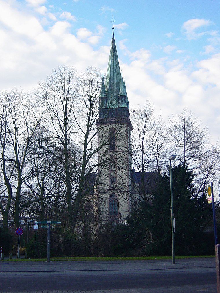
Photo: Wikimedia, CC BY-SA 3.0.
Herz-Jesu-Kirche is a church, which is situated 280 metres west of Hotel am Stadtpark Ringhotel.
Rathaus
Town hall

Photo: Dat doris, CC BY-SA 4.0.
Rathaus is a town hall, which is situated 550 metres northwest of Hotel am Stadtpark Ringhotel.
Places in the Area
Nearby places include Lünen and Lünen-Süd.
Lünen
Town
 Lünen is a town with around 86000 inhabitants in North Rhine-Westphalia, Germany. It is located north of Dortmund, on both banks of the River Lippe. It is the largest town of the Unna district and part of the Ruhr Area.

Gahmen
Suburb

Photo: Potupin, Public domain.
Gahmen is a suburb, which is situated 3 km southwest of Hotel am Stadtpark Ringhotel.
Hotel am Stadtpark Ringhotel
- Category: transportation
- Location: Lünen, Unna, Arnsberg, North Rhine-Westphalia, Germany, Central Europe, Europe
- View on OpenStreetMap
Latitude
51.6108° or 51° 36′ 39″ northLongitude
7.52659° or 7° 31′ 36″ eastOpen location code
9F39JG6G+8JOpenStreetMap ID
way 162259942OpenStreetMap feature
amenity=parkingOpenStreetMap attribute
parking=surfaceOpenStreetMap attribute
wheelchair=yes
This page is based on OpenStreetMap, Wikidata, and Wikimedia Commons.
We’d love your help improving our open data sources. Thank you for contributing.
Satellite Map
Discover Hotel am Stadtpark Ringhotel from above in high-definition satellite imagery.
Notable Places Nearby
Highlights include Ringhotel Am Stadtpark and Hansesaal Lünen.
Nearby Places
Explore places such as Hansesaal and Harlekin.
North Rhine-Westphalia: Must-Visit Destinations
Delve into Cologne, Düsseldorf, Bonn, and Dortmund.
Curious Parking Areas to Discover
Uncover intriguing parking areas from every corner of the globe.
About Mapcarta. Data © OpenStreetMap contributors and available under the Open Database License". Text is available under the CC BY-SA 4.0 license, except for photos, directions, and the map. Photo: Daniel Schwen, CC BY-SA 2.5.