Jaxmotech
Jaxmotech is a building in Saarlouis, Saarland which is located on Ostring. Jaxmotech is situated nearby to Casino Fraulautern, as well as near the cemetery Friedhof Fraulautern.| Tap on a place to explore it |
Places of Interest Nearby
Highlights include St. Josef (Saarlouis) and Saar Polygon.
St. Josef (Saarlouis)
Church

Photo: Matthwiki, CC BY-SA 3.0 de.
St. Josef (Saarlouis) is a church, which is situated 1 km west of Jaxmotech.
Saar Polygon
Scenic viewpoint

Photo: Milseburg, CC BY-SA 4.0.
The Saar Polygon in Ensdorf, Saarland is a monument commemorating the coal mining industry in Saarland, which ended in June 2012. Saar Polygon is situated 2 km south of Jaxmotech.
St. Johannes
Church
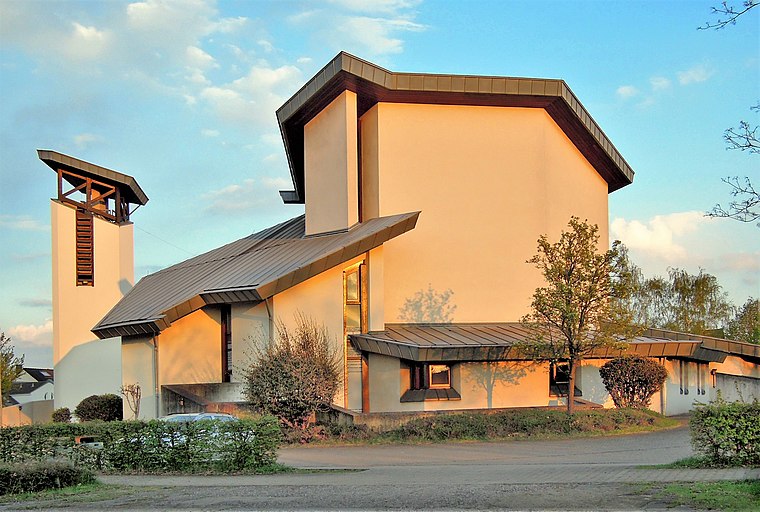
Photo: LoKiLeCh, CC BY-SA 3.0.
St. Johannes is a church, which is situated 1½ km west of Jaxmotech.
Places in the Area
Nearby places include Saarwellingen and Ensdorf.
Saarwellingen
Village
 Saarwellingen is a municipality in the district of Saarlouis in Saarland, Germany. As of 2022 it has a population of 13,302.
Ensdorf
Village

Photo: Lokilech, CC BY-SA 3.0.
Ensdorf is a municipality in the district of Saarlouis, in Saarland, Germany. It is on the right bank of the river Saar, opposite Saarlouis, approximately 20 km northwest of Saarbrücken. Ensdorf is situated 3½ km south of Jaxmotech.
Saarlouis
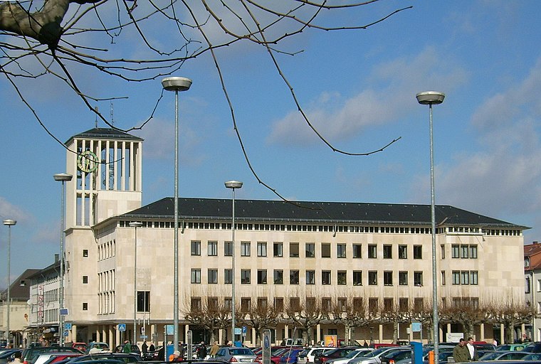
Photo: Kolling, CC BY-SA 3.0.
Saarlouis is a city and district in Saarland. With close to 200,000 inhabitants, it is the second most populous district in Saarland after neighbouring Saarbrücken, though only about 35,000 live in the city of Saarlouis itself.
Jaxmotech
- Type: Building
- Address: Ostring 60, Saarlouis, 66740
- Location: Saarlouis, Saarland, Germany, Central Europe, Europe
- View on OpenStreetMap
Latitude
49.33328° or 49° 19′ 60″ northLongitude
6.79351° or 6° 47′ 37″ eastOpen location code
8FX88QMV+8COpenStreetMap ID
way 163462589OpenStreetMap feature
building=yes
This page is based on OpenStreetMap, Wikidata, and Wikimedia Commons.
We’d love your help improving our open data sources. Thank you for contributing.
Satellite Map
Discover Jaxmotech from above in high-definition satellite imagery.
Notable Places Nearby
Highlights include Casino Fraulautern and Friedhof Fraulautern.
Nearby Places
Explore places such as Sertronics and Sacksteder.
Saarland: Must-Visit Destinations
Delve into Saarbrücken, Saarlouis, Homburg, and Merzig.
Curious Buildings to Discover
Uncover intriguing buildings from every corner of the globe.
About Mapcarta. Data © OpenStreetMap contributors and available under the Open Database License". Text is available under the CC BY-SA 4.0 license, except for photos, directions, and the map. Photo: wolfgangstaudt, CC BY 2.0.