Résidence Orionde
Résidence Orionde is a residential building in Les Déserts, Arrondissement of Chambéry, Auvergne-Rhône-Alpes. Résidence Orionde is situated nearby to the hamlet La Féclaz, as well as near the tourism office Office de tourisme Savoie Grand Revard.| Tap on a place to explore it |
Places of Interest Nearby
Highlights include Chapelle Notre-Dame-des-Neiges de la Féclaz and Nivolet.
Chapelle Notre-Dame-des-Neiges de la Féclaz
Church

Photo: Lev. Anthony, CC BY-SA 4.0.
Chapelle Notre-Dame-des-Neiges de la Féclaz is a church, which is situated 310 metres east of Résidence Orionde.
Nivolet
Scenic viewpoint
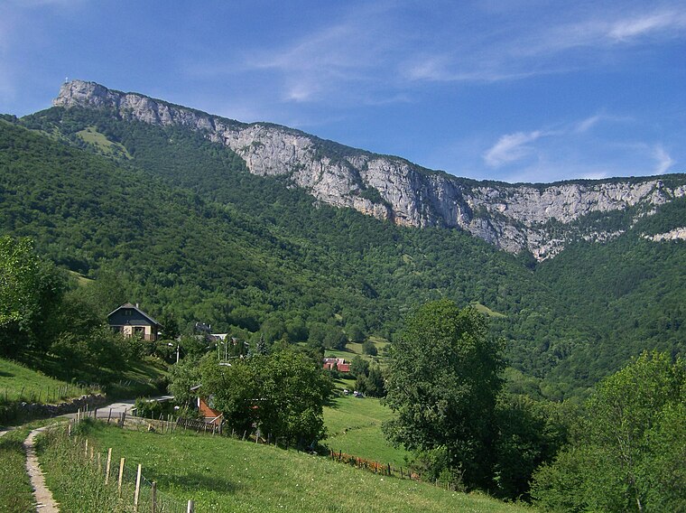
Photo: Wikimedia, CC BY-SA 3.0.
The Nivolet is a mountain of the Bauges Massif in the French Prealps in Savoie, France. Overlooking the city of Chambéry, the Nivolet cross is located at the summit since 1861. Nivolet is situated 3½ km south of Résidence Orionde.
Col de Plainpalais
Mountain saddle

Photo: Guilhem Vellut, CC BY 2.0.
Col de Plainpalais is a mountain saddle, which is situated 3 km east of Résidence Orionde.
Places in the Area
Nearby places include La Féclaz and Méry.

Méry
Village

Photo: Wikimedia, CC BY-SA 3.0.
Méry is a commune in the Savoie department in the Auvergne-Rhône-Alpes region in south-eastern France. It is part of the urban area of Chambéry. Méry is situated 3½ km west of Résidence Orionde.
Drumettaz-Clarafond
Village

Photo: Mathis73, CC BY-SA 4.0.
Drumettaz-Clarafond is a commune in the Savoie department in the Auvergne-Rhône-Alpes region in south-eastern France. Drumettaz-Clarafond is situated 4½ km west of Résidence Orionde.
Résidence Orionde
- Type: Residential building
- Category: building
- Location: Les Déserts, Arrondissement of Chambéry, Savoie, Auvergne-Rhône-Alpes, France, Europe
- View on OpenStreetMap
Latitude
45.64404° or 45° 38′ 39″ northLongitude
5.98252° or 5° 58′ 57″ eastOpen location code
8FQ7JXVM+J2OpenStreetMap ID
way 166252246OpenStreetMap feature
building=residential
This page is based on OpenStreetMap, Wikidata, and Wikimedia Commons.
We’d love your help improving our open data sources. Thank you for contributing.
Satellite Map
Discover Résidence Orionde from above in high-definition satellite imagery.
Notable Places Nearby
Highlights include Place Centrale La Féclaz and Office de tourisme Savoie Grand Revard.
Nearby Places
Explore places such as Guerraz Sports and Guerraz Sports, l’Avalanche.
Savoie: Must-Visit Destinations
Delve into Chambéry, Aix-les-Bains, Val-d’Isère, and Bourg-Saint-Maurice.
Curious Residential Buildings to Discover
Uncover intriguing residential buildings from every corner of the globe.
About Mapcarta. Data © OpenStreetMap contributors and available under the Open Database License". Text is available under the CC BY-SA 4.0 license, except for photos, directions, and the map. Photo: Mrhugues, CC BY-SA 3.0.