Evangelisches Gemeindezentrum
Evangelisches Gemeindezentrum is a building in Reutlingen, Tübingen Region, Baden-Württemberg which is located on Mahdachstraße. Evangelisches Gemeindezentrum is situated nearby to the church Sankt Johannes der Täufer, as well as near the cemetery Friedhof Ohmenhausen.| Tap on a place to explore it |
Photo: Wikimedia, CC BY-SA 4.0.
Places of Interest Nearby
Highlights include Sankt Johannes der Täufer and Waldstadion.
Sankt Johannes der Täufer
Church

Photo: Wikimedia, CC BY-SA 4.0.
Sankt Johannes der Täufer is a church, which is situated 110 metres west of Evangelisches Gemeindezentrum.
Waldstadion
Stadium

Photo: Wikimedia, CC BY-SA 4.0.
Waldstadion is a stadium, which is situated 360 metres southwest of Evangelisches Gemeindezentrum.
Turn- und Festhalle
Sports venue

Photo: Wikimedia, CC BY-SA 4.0.
Turn- und Festhalle is a sports venue, which is situated 390 metres south of Evangelisches Gemeindezentrum.
Places in the Area
Nearby places include Immenhausen and Bronnweiler.
Immenhausen
Village

Photo: Windharp, CC BY-SA 4.0.
Immenhausen is a village, which is situated 2½ km west of Evangelisches Gemeindezentrum.
Bronnweiler
Village

Photo: Stoeffelbrun, Public domain.
Bronnweiler is a village, which is situated 3 km south of Evangelisches Gemeindezentrum.
Gomaringen
Village
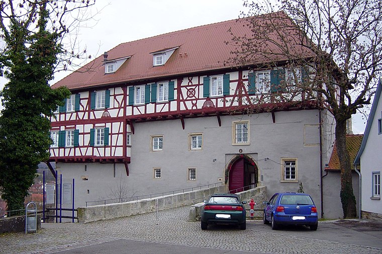
Photo: Weitbrecht, Public domain.
Gomaringen is a municipality located about 10 km south of Tübingen in the German state of Baden-Württemberg. Gomaringen is situated 3½ km southwest of Evangelisches Gemeindezentrum.
Evangelisches Gemeindezentrum
- Type: Building
- Address: Mahdachstraße 50, Ohmenhausen, Reutlingen, 72770
- Category: religious community center
- Location: Reutlingen, Reutlingen, Tübingen Region, Swabian Mountains, Baden-Württemberg, Germany, Central Europe, Europe
- View on OpenStreetMap
Latitude
48.47328° or 48° 28′ 24″ northLongitude
9.13681° or 9° 8′ 13″ eastOpen location code
8FWFF4FP+8POpenStreetMap ID
way 167424473OpenStreetMap feature
building=yesWikidata ID
Q124154851
This page is based on OpenStreetMap, Wikidata, and Wikimedia Commons.
We’d love your help improving our open data sources. Thank you for contributing.
Satellite Map
Discover Evangelisches Gemeindezentrum from above in high-definition satellite imagery.
In Other Languages
“Evangelisches Gemeindezentrum” goes by many names.
Places with the Same Name
Discover other places named “Evangelisches Gemeindezentrum”.
Notable Places Nearby
Highlights include Friedhof Ohmenhausen and Leichenhalle.
Nearby Places
Explore places such as Evangelischer Kindergarten and Schnitt Punkt.
Swabian Mountains: Must-Visit Destinations
Delve into Ulm, Tübingen, Heidenheim, and Tuttlingen.
Curious Buildings to Discover
Uncover intriguing buildings from every corner of the globe.
About Mapcarta. Data © OpenStreetMap contributors and available under the Open Database License". Text is available under the CC BY-SA 4.0 license, except for photos, directions, and the map. Photo: Wikimedia, CC BY-SA 4.0.