Industriegebiet Kindleber Straße
Industriegebiet Kindleber Straße is in Gotha, Thuringia, and is located on Kindleber Straße. Industriegebiet Kindleber Straße is situated nearby to the hamlet Kindleben, as well as near the aerodrome Gotha-Ost airfield.| Tap on a place to explore it |
Places of Interest Nearby
Highlights include Gotha-Ost airfield and Gotha Ost station.
Gotha-Ost airfield
Aerodrome

Photo: Carsten Steger, CC BY-SA 4.0.
Gotha-Ost airfield is an aerodrome.
Gotha Ost station
Railway station

Photo: Jwaller, CC BY-SA 3.0.
Gotha Ost station is a railway station in the municipality of Gotha, located in the Gotha district in Thuringia, Germany. Gotha Ost station is situated 1½ km southwest of Industriegebiet Kindleber Straße.
Altes Rathaus
Town hall
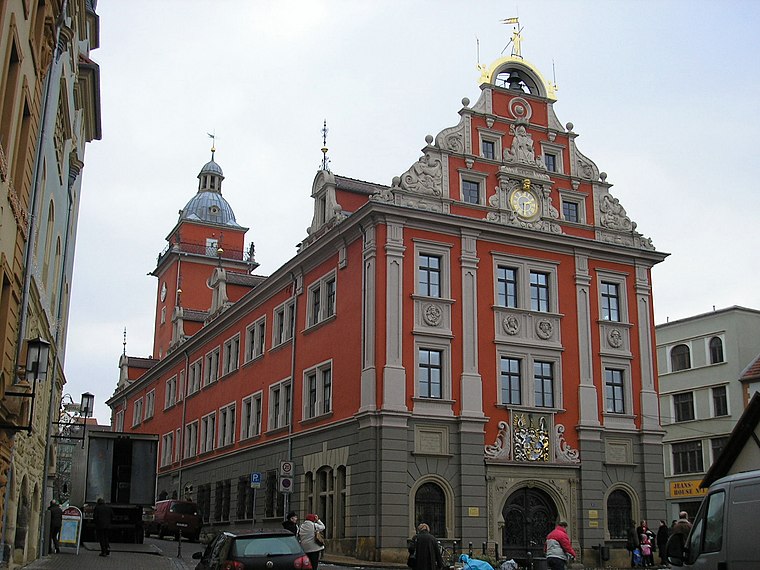
Photo: Michael Sander, CC BY-SA 3.0.
Altes Rathaus is a town hall, which is situated 3½ km southwest of Industriegebiet Kindleber Straße.
Places in the Area
Nearby places include Kindleben and Siebleben.

Siebleben
Village
 Siebleben is a village, which is situated 3 km south of Industriegebiet Kindleber Straße.
Bufleben
Village

Photo: CTHOE, CC BY-SA 4.0.
Bufleben is a village and Ortschaft of the municipality Nessetal in the district of Gotha, in Thuringia, Germany. Before 1 January 2019, when it was merged into the new municipality Nessetal, it was an independent municipality. Bufleben is situated 3 km north of Industriegebiet Kindleber Straße.
Industriegebiet Kindleber Straße
- Type: Industry
- Address: Kindleber Straße 188, Gotha, 99867
- Location: Gotha, Gotha, Thuringia, Germany, Central Europe, Europe
- View on OpenStreetMap
Latitude
50.97065° or 50° 58′ 14″ northLongitude
10.74081° or 10° 44′ 27″ eastOpen location code
9F2GXPCR+78OpenStreetMap ID
way 168186259OpenStreetMap feature
landuse=industrial
This page is based on OpenStreetMap, Wikidata, and Wikimedia Commons.
We’d love your help improving our open data sources. Thank you for contributing.
Satellite Map
Discover Industriegebiet Kindleber Straße from above in high-definition satellite imagery.
Notable Places Nearby
Highlights include Bahnhof Gotha Ost and Klaus-Törpe-Sportpark.
Nearby Places
Explore places such as PHOENIX Vertriebszentrum and Raab Karcher Baustoffe GmbH.
Curious Places to Discover
Uncover intriguing places from every corner of the globe.
About Mapcarta. Data © OpenStreetMap contributors and available under the Open Database License". Text is available under the CC BY-SA 4.0 license, except for photos, directions, and the map. Photo: SchiDD, CC BY-SA 4.0.