Freie internationale Tankstelle
Freie internationale Tankstelle is a hut in Berlin, Berlin which is located on Schwedter Straße. Freie internationale Tankstelle is situated nearby to the art gallery Atelier Sam Grigorian, as well as near EastSeven Berlin Hostel.| Tap on a place to explore it |
Places of Interest Nearby
Highlights include Museum for Architectural Drawing and Fernsehturm Berlin.
Museum for Architectural Drawing
Museum

Photo: Code, CC BY-SA 3.0 de.
The Museum for Architectural Drawing is a private museum in Berlin, Germany run by the Tchoban Foundation. It was opened in June 2013. Three to four exhibitions are shown each year, made up of drawings from the Tchoban Foundation’s collection and from works on loan in cooperation with other museums and institutions. Museum for Architectural Drawing is situated 160 metres south of Freie internationale Tankstelle.
Fernsehturm Berlin
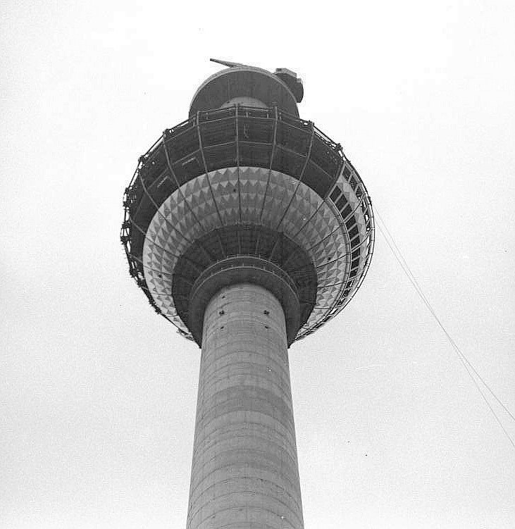
Photo: Wikimedia, CC BY-SA 3.0 de.
The Fernsehturm in central Berlin was constructed between 1965 and 1969 by the government of the German Democratic Republic as both a functional broadcasting facility and a symbol of Communist power. Fernsehturm Berlin is situated 1½ km south of Freie internationale Tankstelle.
Teutoburger Platz
Park

Photo: Wikimedia, CC BY-SA 3.0.
Teutoburger Platz is a park, which is situated 180 metres south of Freie internationale Tankstelle.
Places in the Area
Nearby places include Scheunenviertel and Spandauer Vorstadt.
Scheunenviertel
Neighborhood
Scheunenviertel is a neighborhood of Mitte in the centre of Berlin. It is situated to the north of the medieval Altberlin area, east of the Rosenthaler Straße and Hackescher Markt.
Spandauer Vorstadt
Quarter
Spandauer Vorstadt is a historic district in what is now the Mitte district of Berlin.

Freie internationale Tankstelle
- Type: Hut
- Address: Schwedter Straße 261, Prenzlauer Berg, Berlin, 10119
- Category: building
- Location: Berlin, Berlin, Stadt, Berlin, Germany, Central Europe, Europe
- View on OpenStreetMap
Latitude
52.53346° or 52° 32′ 1″ northLongitude
13.40975° or 13° 24′ 35″ eastOpen location code
9F4MGCM5+9VOpenStreetMap ID
way 168713480OpenStreetMap feature
building=hut
This page is based on OpenStreetMap, Wikidata, and Wikimedia Commons.
We’d love your help improving our open data sources. Thank you for contributing.
Satellite Map
Discover Freie internationale Tankstelle from above in high-definition satellite imagery.
Notable Places Nearby
Highlights include Atelier Sam Grigorian and EastSeven Berlin Hostel.
Nearby Places
Explore places such as freie internationale tankstelle and Five Elephant.
Berlin: Must-Visit Destinations
Delve into Mitte, East Central, City West, and East Berlin.
Curious Huts to Discover
Uncover intriguing huts from every corner of the globe.
About Mapcarta. Data © OpenStreetMap contributors and available under the Open Database License". Text is available under the CC BY-SA 4.0 license, except for photos, directions, and the map. Photo: Berthold Werner, CC BY-SA 3.0.