Plan d’eau des Communaux
Plan d’eau des Communaux is in Greater Lyon, Auvergne-Rhône-Alpes. Plan d’eau des Communaux is situated nearby to the amusement arcade Destination VR, as well as near the sports venue Foot Indoor Park.| Tap on a place to explore it |
Places of Interest Nearby
Highlights include Château de Saint-Bernard and Gare d’Anse.
Château de Saint-Bernard

Photo: DELAVOGE, CC BY-SA 3.0.
Château de Saint-Bernard is situated 700 metres east of Plan d’eau des Communaux.
Gare d’Anse
Railway station
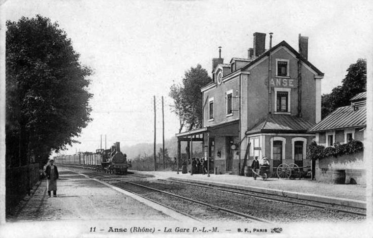
Photo: Wikimedia, Public domain.
Gare d’Anse is a railway station, which is situated 680 metres southwest of Plan d’eau des Communaux.
Église Saint-Bernard de Saint-Bernard
Church

Photo: Michiel1972, CC BY-SA 3.0.
Église Saint-Bernard de Saint-Bernard is a church, which is situated 670 metres east of Plan d’eau des Communaux.
Places in the Area
Nearby places include Anse and Ambérieux.
Anse
Village

Photo: Ansesolo, CC BY-SA 3.0.
Anse is a commune in the Rhône department in eastern France. It is situated on the river Saône, approx. 7 km south of Villefranche-sur-Saône.
Ambérieux
Village

Photo: Klodo6975, CC BY-SA 3.0.
Ambérieux, also known as Ambérieux-d'Azergues, is a commune in the Rhône department and the region of Auvergne-Rhône-Alpes, eastern France.
Pommiers
Village

Photo: Ansesolo, CC BY-SA 3.0.
Pommiers is a commune in the Rhône department in eastern France. Pommiers is situated 2½ km northwest of Plan d’eau des Communaux.
Plan d’eau des Communaux
- Type: Body of water
- Location: Greater Lyon, Auvergne-Rhône-Alpes, France, Europe
- View on OpenStreetMap
Latitude
45.9449° or 45° 56′ 42″ northLongitude
4.72361° or 4° 43′ 25″ eastOpen location code
8FQ6WPVF+XCOpenStreetMap ID
way 17042881OpenStreetMap feature
natural=water
This page is based on OpenStreetMap, Wikidata, and Wikimedia Commons.
We’d love your help improving our open data sources. Thank you for contributing.
Satellite Map
Discover Plan d’eau des Communaux from above in high-definition satellite imagery.
Notable Places Nearby
Highlights include Destination VR and Foot Indoor Park.
Nearby Places
Explore places such as Au Colombier and Ponton de mise à l’eau de Anse.
Greater Lyon: Must-Visit Destinations
Delve into Lyon, Saint-Étienne, Roanne, and Villefranche-sur-Saône.
Curious Places to Discover
Uncover intriguing places from every corner of the globe.
About Mapcarta. Data © OpenStreetMap contributors and available under the Open Database License". Text is available under the CC BY-SA 4.0 license, except for photos, directions, and the map. Photo: Goudan07, CC BY-SA 3.0.