Cala’n Busquets
Cala’n Busquets is a bay in Ciutadella, Balearic Islands, Balearic Islands.| Tap on a place to explore it |
Places of Interest
Highlights include Cathedral of Minorca and Hypogeum of Torre del Ram.
Cathedral of Minorca
Church

Photo: Fernando, CC BY-SA 4.0.
The Cathedral-Basilica of Saint Mary is a Roman Catholic church in Ciutadella de Menorca, in the island of Menorca, in Balearic Islands, Spain. It was constructed from 1300 to 1362 in the Catalan Gothic style.
Hypogeum of Torre del Ram
Archaeological site

Photo: Ainacass, CC BY-SA 4.0.
The Hypogeum of Torre del Ram is an archaeological site in Cala en Blanes, Ciutadella de Menorca. It is a Bronze Age funerary hypogeum, which was used as a collective tomb by a family or a small community.
Ciutadella Lighthouse
Scenic viewpoint
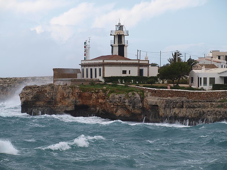
Photo: Joan Martinez, CC BY 2.0.
The Ciutadella, Punta de Sa Farola or Sa Farola Lighthouse is an active 19th century lighthouse on the Spanish island of Menorca. Originally completed in 1863, the tower has subsequently undergone a number of modifications.
Cala’n Busquets
- Type: Bay
- Category: body of water
- Location: Ciutadella, Balearic Islands, Menorca, Balearic Islands, Spain, Iberia, Europe
- View on OpenStreetMap
Latitude
39.9998° or 39° 59′ 59″ northLongitude
3.8278° or 3° 49′ 40″ eastOpen location code
8FF5XRXH+W4OpenStreetMap ID
way 171454503OpenStreetMap feature
natural=bay
This page is based on OpenStreetMap, Wikidata, and Wikimedia Commons.
We’d love your help improving our open data sources. Thank you for contributing.
Satellite Map
Discover Cala’n Busquets from above in high-definition satellite imagery.
Localities in the Area
Explore places such as Son Oleo and Cala’N Blanes.
Notable Places Nearby
Highlights include oficina portuaria and Puerto de Ciudadela.
Menorca: Must-Visit Destinations
Delve into Maó, Es Mercadal, Cala Galdana, and Cala en Bosch.
Curious Bays to Discover
Uncover intriguing bays from every corner of the globe.
About Mapcarta. Data © OpenStreetMap contributors and available under the Open Database License". Text is available under the CC BY-SA 4.0 license, except for photos, directions, and the map. Photo: Ben Salter, CC BY 2.0.