Kids Cooking Club
Kids Cooking Club is a school building in Glyfada, Athens Prefecture, Attica. Kids Cooking Club is situated nearby to the park Xenofontos Square, as well as near Πλατεία Ηρώων.| Tap on a place to explore it |
Places of Interest Nearby
Highlights include Agios Konstantinos and Glyfada Attiki.
Agios Konstantinos
Church
 Agios Konstantinos is a church, which is situated 750 metres southwest of Kids Cooking Club.
Glyfada Attiki
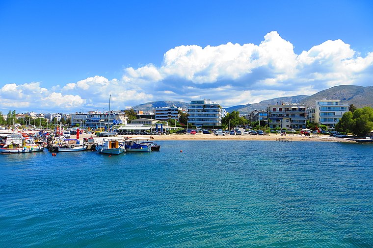
Beach

Photo: Cypkipras55, CC0.
Glyfada Attiki is a beach, which is situated 1 km south of Kids Cooking Club.
Marina Agios Kosmas
Marina
The Agios Kosmas Olympic Sailing Centre hosted the sailing events at the 2004 Summer Olympics in Athens, Greece. The center is located about four miles from downtown Athens along the coast. Marina Agios Kosmas is situated 2½ km west of Kids Cooking Club.
Places in the Area
Nearby places include Glyfada and Voula.
Glyfada
Suburb
 Glyfada is a town and a suburb in the South Athens regional unit located in the Athens Riviera along the coast of the Saronic Gulf. It is situated in the southern parts of the Athens urban area.
Voula
Suburb

Photo: ESPON34, CC BY-SA 4.0.
Voula is a southern suburb of Athens along the Athens coast and former municipality in East Attica, Greece. Since the 2011 local government reform it is part of the municipality Vari-Voula-Vouliagmeni, of which it is the seat and a municipal unit. Voula is situated 3 km south of Kids Cooking Club.
Vari-Voula-Vouliagmeni
 The Vari-Voula-Vouliagmeni is a municipality in Attica, the historic region of Athens city-state. It is part of Athens' urban area.
Kids Cooking Club
- Type: School building
- Categories: building and education
- Location: Glyfada, Athens Prefecture, Attica, Greece, Balkans, Europe
- View on OpenStreetMap
Latitude
37.8693° or 37° 52′ 10″ northLongitude
23.75207° or 23° 45′ 7″ eastOpen location code
8G95VQ92+PROpenStreetMap ID
way 171568986OpenStreetMap feature
building=school
This page is based on OpenStreetMap, Wikidata, and Wikimedia Commons.
We’d love your help improving our open data sources. Thank you for contributing.
Satellite Map
Discover Kids Cooking Club from above in high-definition satellite imagery.
Notable Places Nearby
Highlights include Xenofontos Square and Πλατεία Ηρώων.
Nearby Places
Explore places such as ΓΥΜΝΑΣΙΟ and ΑΓ. ΝΙΚΟΛΑΟΣ.
Greece: Must-Visit Destinations
Delve into Athens, Thessaloniki, Lesvos, and Arcadia.
Curious Schools to Discover
Uncover intriguing schools from every corner of the globe.
About Mapcarta. Data © OpenStreetMap contributors and available under the Open Database License". Text is available under the CC BY-SA 4.0 license, except for photos, directions, and the map. Photo: Ggia, CC BY-SA 3.0.