Gasthof Krone Forch
Gasthof Krone Forch is a restaurant in Küsnacht (ZH), Meilen District, Canton of Zurich which is located on General-Guisan-Strasse. Gasthof Krone Forch is situated nearby to the cave Franzosenhöhe, as well as near Forch railway station.| Tap on a place to explore it |
- Email: info@kroneforch.ch
- Type: Restaurant
- Address: General-Guisan-Strasse 1, Forch, 8127
Places of Interest Nearby
Highlights include Forch railway station and Forchdenkmal.
Forch railway station
Railway station

Photo: Roland zh, CC BY-SA 3.0.
Forch is a railway station in the Swiss canton of Zurich and the municipality of Küsnacht, serving the village of Forch. It is the principal intermediate station and headquarters of the Forch Railway, which is operated as Zurich S-Bahn service S18 and provides links to the city of Zurich and the nearby village of Esslingen. Forch railway station is situated 170 metres southwest of Gasthof Krone Forch.

Scheuren railway station
Railway station
 Scheuren railway station is situated 800 metres southeast of Gasthof Krone Forch.
Places in the Area
Nearby places include Forch and Zumikon.
Forch
Village

Photo: Wikimedia, CC BY-SA 3.0.
Forch is a village and a mountain pass located in the municipalities of Küsnacht and Maur in the canton of Zürich, Switzerland.
Zumikon
Village

Photo: Parpan05, CC BY-SA 3.0.
Zumikon is a municipality in the district of Meilen in the canton of Zürich in Switzerland. It is located in the Pfannenstiel region.
Maur
Village
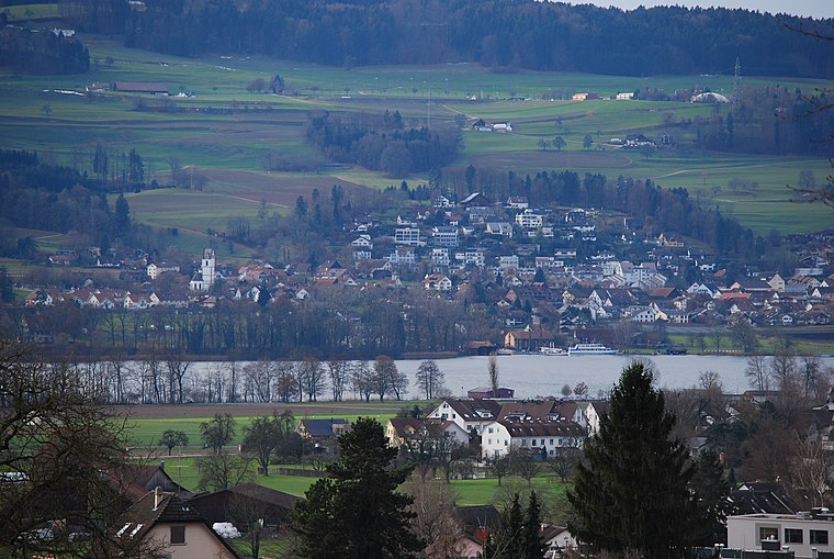
Photo: DidiWeidmann, CC BY-SA 3.0.
Maur is a municipality in the district of Uster in the canton of Zürich in Switzerland.
Gasthof Krone Forch
- Categories: building and food
- Location: Küsnacht (ZH), Meilen District, Canton of Zurich, Switzerland, Central Europe, Europe
- View on OpenStreetMap
Latitude
47.32587° or 47° 19′ 33″ northLongitude
8.65018° or 8° 39′ 1″ eastOpen location code
8FVC8MG2+83OpenStreetMap ID
way 171918533OpenStreetMap feature
amenity=restaurantOpenStreetMap feature
building=yes
This page is based on OpenStreetMap, Wikidata, and Wikimedia Commons.
We’d love your help improving our open data sources. Thank you for contributing.
Satellite Map
Discover Gasthof Krone Forch from above in high-definition satellite imagery.
Notable Places Nearby
Highlights include Franzosenhöhe and Bibliothek Aesch-Forch.
Nearby Places
Explore places such as Küsnachterberg und Forch and Depotwerkstätte Forch.
Switzerland: Must-Visit Destinations
Delve into Zurich, Berne, Geneva, and Basel.
Curious Restaurants to Discover
Uncover intriguing restaurants from every corner of the globe.
About Mapcarta. Data © OpenStreetMap contributors and available under the Open Database License". Text is available under the CC BY-SA 4.0 license, except for photos, directions, and the map. Photo: Wikimedia, CC0.