Χώρος Στάθμευσης Μικρής Διάρκειας P2
Χώρος Στάθμευσης Μικρής Διάρκειας P2 is a parking area in Spata-Artemida, East Attica. Χώρος Στάθμευσης Μικρής Διάρκειας P2 is situated nearby to the hotel Sofitel Athens Airport, as well as near the post office Hellenic Post.| Tap on a place to explore it |
Places of Interest Nearby
Highlights include Airport and Tower of Vravrona.
Airport
Railway station
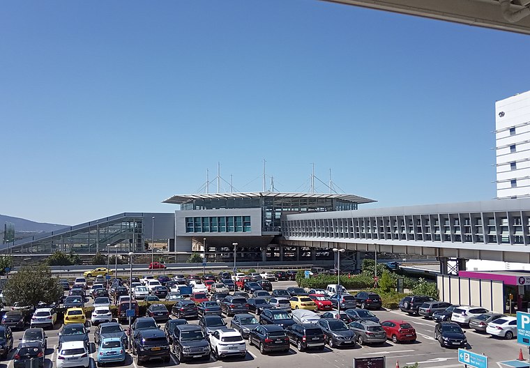
Photo: Peloponnisios, CC BY-SA 4.0.
Athens Airport, also known as Athens International Airport on signage, is a railway station and metro station that serves the international airport of Athens, Greece. Airport is situated 270 metres southwest of Χώρος Στάθμευσης Μικρής Διάρκειας P2.
Tower of Vravrona
Tower
 Tower of Vravrona is situated 3 km south of Χώρος Στάθμευσης Μικρής Διάρκειας P2.
Places in the Area
Nearby places include Spata and Vravrona Markopoulou.
Spata

Photo: C messier, CC BY-SA 3.0.
Spata is mostly a residential town and in many ways as a suburb of Athens, which lies 20km to the west. Athens International Airport is situated on Spata grounds and sometimes referred to as Spata Airport.
Vravrona Markopoulou
Hamlet

Photo: Dimkoa, Public domain.
Vravrona Markopoulou is a hamlet, which is situated 6 km east of Χώρος Στάθμευσης Μικρής Διάρκειας P2.
Markopoulo Mesogaias
Town
Markopoulo Mesogaias is a town and a municipality in East Attica, Greece. The municipality has an area of 81.844 km2. Markopoulo Mesogaias is situated 6 km south of Χώρος Στάθμευσης Μικρής Διάρκειας P2.
Χώρος Στάθμευσης Μικρής Διάρκειας P2
- Type: Parking area
- Parking: surface
- Category: transportation
- Location: Spata-Artemida, East Attica, Attica, Greece, Balkans, Europe
- View on OpenStreetMap
Latitude
37.93852° or 37° 56′ 19″ northLongitude
23.94712° or 23° 56′ 50″ eastOpen location code
8G95WWQW+CROpenStreetMap ID
way 174827239OpenStreetMap feature
amenity=parkingOpenStreetMap attribute
parking=surface
This page is based on OpenStreetMap, Wikidata, and Wikimedia Commons.
We’d love your help improving our open data sources. Thank you for contributing.
Satellite Map
Discover Χώρος Στάθμευσης Μικρής Διάρκειας P2 from above in high-definition satellite imagery.
Notable Places Nearby
Highlights include Sofitel Athens Airport and Hellenic Post.
Nearby Places
Explore places such as ΑΕΡΟΛΙΜΕΝΑΣ ΑΘΗΝΩΝ and ΑΕΡΟΛΙΜΕΝΑΣ ΑΘΗΝΩΝ.
Greece: Must-Visit Destinations
Delve into Athens, Thessaloniki, Lesvos, and Arcadia.
Curious Parking Areas to Discover
Uncover intriguing parking areas from every corner of the globe.
About Mapcarta. Data © OpenStreetMap contributors and available under the Open Database License". Text is available under the CC BY-SA 4.0 license, except for photos, directions, and the map. Photo: Ggia, CC BY-SA 3.0.