Hof Lüttkevitz
Hof Lüttkevitz is a farm in Wiek, Landkreis Vorpommern-Rügen, Mecklenburg-Western Pomerania. Hof Lüttkevitz is situated nearby to the village Juliusruh.| Tap on a place to explore it |
Places of Interest Nearby
Highlights include Pfarrkirche Altenkirchen and St. Georg.
Pfarrkirche Altenkirchen
Church
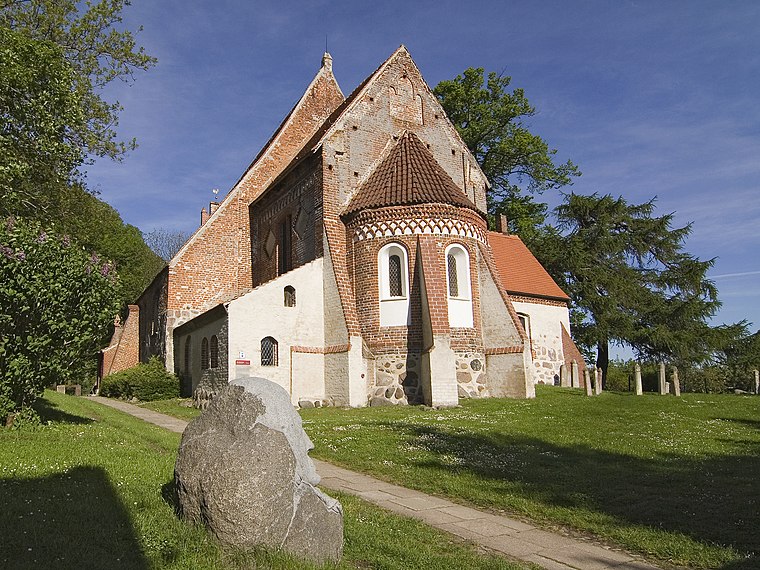
Photo: Unukorno, CC BY-SA 3.0.
Pfarrkirche Altenkirchen is a church, which is situated 2 km east of Hof Lüttkevitz.
St. Georg
Church

Photo: Chron-Paul, CC BY-SA 3.0.
St. Georg is a church, which is situated 2½ km southwest of Hof Lüttkevitz.
Places in the Area
Nearby places include Altenkirchen and Breege-Juliusruh.
Altenkirchen

Photo: Chron-Paul, CC BY-SA 3.0.
Altenkirchen is a municipality in the north of the island of Rügen on the Baltic Sea coast of Germany. It is in the Vorpommern-Rügen district, in the federal state of Mecklenburg-Vorpommern.
Breege-Juliusruh

Photo: Traveler100, CC BY-SA 3.0.
Breege is a village and municipality on the island of Rügen, generally known as Seebad Breege-Juliusruh. The municipality consists of the villages Breege, Juliusruh, Kammin, Lobkevitz and Schmantevitz.
Juliusruh
Village
Juliusruh is a village on the northern coast of the island of Rügen in northeastern Germany. Juliusruh is part of the municipality of Breege. Juliusruh and Breege combined have 821 inhabitants in an area of 15,99 km². Juliusruh is situated 4½ km southeast of Hof Lüttkevitz.
Hof Lüttkevitz
- Type: Farm
- Category: agriculture
- Location: Wiek, Landkreis Vorpommern-Rügen, Mecklenburg-Western Pomerania, Germany, Central Europe, Europe
- View on OpenStreetMap
Latitude
54.6398° or 54° 38′ 23″ northLongitude
13.31206° or 13° 18′ 43″ eastOpen location code
9F6MJ8Q6+WROpenStreetMap ID
way 176073297OpenStreetMap feature
landuse=farmyard
This page is based on OpenStreetMap, Wikidata, and Wikimedia Commons.
We’d love your help improving our open data sources. Thank you for contributing.
Satellite Map
Discover Hof Lüttkevitz from above in high-definition satellite imagery.
Notable Places Nearby
Highlights include Hof Lüttkevitz and Ostseekino.
Nearby Places
Explore places such as Amt Wittow and Lüttkevitz.
Mecklenburg-Western Pomerania: Must-Visit Destinations
Delve into Schwerin, Rostock, Wismar, and Stralsund.
Curious Farms to Discover
Uncover intriguing farms from every corner of the globe.
About Mapcarta. Data © OpenStreetMap contributors and available under the Open Database License". Text is available under the CC BY-SA 4.0 license, except for photos, directions, and the map. Photo: Schiwago, CC BY 2.5.