Kieswerk und Bodendeponie Dorsfeld
Kieswerk und Bodendeponie Dorsfeld is a quarry in Kerpen, Rhein-Erft-Kreis, North Rhine-Westphalia. Kieswerk und Bodendeponie Dorsfeld is situated nearby to the forest Bürgewald Dickbusch, as well as near the village Manheim-neu.| Tap on a place to explore it |
Places of Interest Nearby
Highlights include Burg Bergerhausen and St Mary’s Chapel (Manheim-neu).
Burg Bergerhausen

Photo: Tohma, CC BY-SA 3.0.
Burg Bergerhausen is situated 2½ km south of Kieswerk und Bodendeponie Dorsfeld.
St Mary’s Chapel (Manheim-neu)
Chapel

Photo: Chris06, CC BY-SA 4.0.
St Mary’s Chapel (Manheim-neu) is situated 2 km southeast of Kieswerk und Bodendeponie Dorsfeld.
Erftlandring
Pitch

Photo: El Grafo, CC BY-SA 3.0.
Erftlandring is a pitch, which is situated 2½ km west of Kieswerk und Bodendeponie Dorsfeld.
Places in the Area
Nearby places include Manheim-neu and Sindorf.

Sindorf
Town
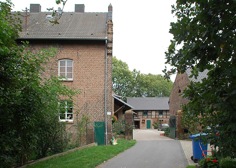
Photo: Achim Raschka, CC BY-SA 4.0.
Sindorf is a town, which is situated 3 km northeast of Kieswerk und Bodendeponie Dorsfeld.
Heppendorf
Village
Heppendorf is a village in the district of Rhein-Erft-Kreis, in North Rhine-Westphalia, Germany. It is part of the municipality Elsdorf. Heppendorf is situated 3 km north of Kieswerk und Bodendeponie Dorsfeld.
Kieswerk und Bodendeponie Dorsfeld
- Type: Quarry
- Category: industry
- Location: Kerpen, Rhein-Erft-Kreis, Cologne District, North Rhine-Westphalia, Germany, Central Europe, Europe
- View on OpenStreetMap
Latitude
50.88499° or 50° 53′ 6″ northLongitude
6.64545° or 6° 38′ 44″ eastOperator
Jacobs StrassenbauOpen location code
9F28VJMW+X5OpenStreetMap ID
way 176264817OpenStreetMap feature
landuse=quarry
This page is based on OpenStreetMap, Wikidata, and Wikimedia Commons.
We’d love your help improving our open data sources. Thank you for contributing.
Satellite Map
Discover Kieswerk und Bodendeponie Dorsfeld from above in high-definition satellite imagery.
Notable Places Nearby
Highlights include Bürgewald Dickbusch and Grünbrücke Steinheide.
Nearby Places
Explore places such as Klarahof and Unterwerk Sindorf.
North Rhine-Westphalia: Must-Visit Destinations
Delve into Cologne, Düsseldorf, Bonn, and Dortmund.
Curious Quarries to Discover
Uncover intriguing quarries from every corner of the globe.
About Mapcarta. Data © OpenStreetMap contributors and available under the Open Database License". Text is available under the CC BY-SA 4.0 license, except for photos, directions, and the map. Photo: Daniel Schwen, CC BY-SA 2.5.