Stadtgärtnerei Waldshut-Tiengen
Stadtgärtnerei Waldshut-Tiengen is a garden in Switzerland. Stadtgärtnerei Waldshut-Tiengen is situated nearby to the pitch Turnverein Waldshut 1849 e.V., as well as near the motorhome stopover Wohnmobil-Park Waldshut.| Tap on a place to explore it |
Places of Interest Nearby
Highlights include Waldshut station and Waldshut–Koblenz Rhine Bridge.
Waldshut station
Railway station

Photo: Chongkian, CC BY-SA 4.0.
Waldshut station is a railway station in the city of Waldshut-Tiengen in the German state of Baden-Württemberg. Waldshut station is situated 1 km northwest of Stadtgärtnerei Waldshut-Tiengen.
Waldshut–Koblenz Rhine Bridge
Bridge

Photo: Chriusha, CC BY-SA 3.0.
The Waldshut–Koblenz Rhine Bridge is a single-track railway bridge on the Turgi–Koblenz–Waldshut railway, between Waldshut and Koblenz AG, crossing the Rhine and the border between Germany and Switzerland. Waldshut–Koblenz Rhine Bridge is situated 1 km southeast of Stadtgärtnerei Waldshut-Tiengen.
Koblenz railway station
Railway station
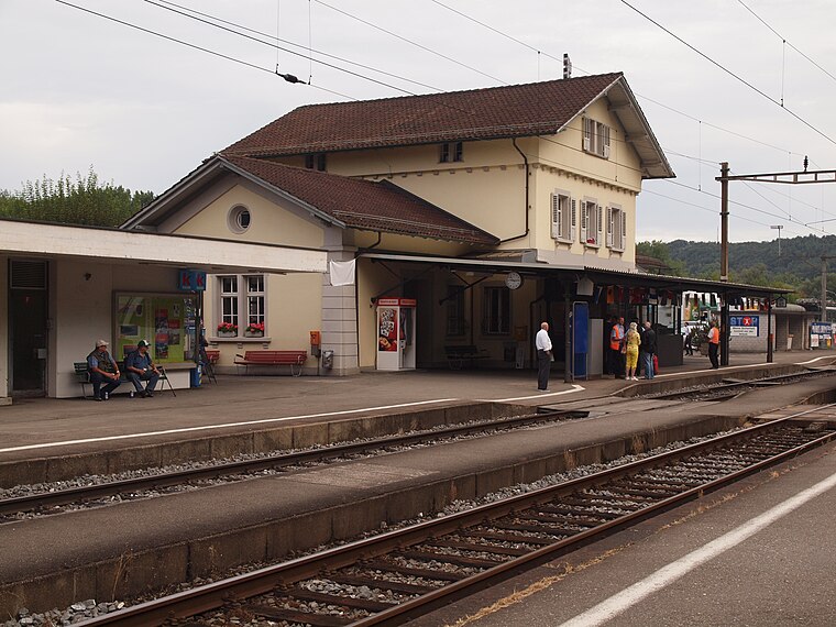
Photo: Bobo11, CC BY-SA 3.0.
Koblenz railway station is a railway station in the Swiss canton of Aargau and municipality of Koblenz. The station is located at junction of the Turgi to Waldshut railway line with the Winterthur to Koblenz line and the freight only Koblenz to Stein-Säckingen line. Koblenz railway station is situated 1½ km south of Stadtgärtnerei Waldshut-Tiengen.
Places in the Area
Nearby places include Koblenz and Waldshut.
Koblenz
Village

Photo: Badener, CC BY-SA 3.0.
Koblenz is a town and municipality in the district of Zurzach in the canton of Aargau in Switzerland.

Koblenzer Laufen
Locality

Photo: Mboesch, CC BY-SA 3.0.
Koblenzer Laufen is a locality, which is situated 3 km east of Stadtgärtnerei Waldshut-Tiengen.
Stadtgärtnerei Waldshut-Tiengen
- Type: Garden
- Category: recreation area
- Location: Switzerland, Central Europe, Europe
- View on OpenStreetMap
Latitude
47.61336° or 47° 36′ 48″ northLongitude
8.22479° or 8° 13′ 29″ eastOpen location code
8FVCJ67F+8WOpenStreetMap ID
way 176855504OpenStreetMap feature
leisure=garden
This page is based on OpenStreetMap, Wikidata, and Wikimedia Commons.
We’d love your help improving our open data sources. Thank you for contributing.
Satellite Map
Discover Stadtgärtnerei Waldshut-Tiengen from above in high-definition satellite imagery.
Notable Places Nearby
Highlights include Turnverein Waldshut 1849 e.V. and Wohnmobil-Park Waldshut.
Nearby Places
Explore places such as E-Bike Verleihstation and Rhein-Camping Waldshut.
Switzerland: Must-Visit Destinations
Delve into Zurich, Berne, Geneva, and Basel.
Curious Gardens to Discover
Uncover intriguing gardens from every corner of the globe.
About Mapcarta. Data © OpenStreetMap contributors and available under the Open Database License". Text is available under the CC BY-SA 4.0 license, except for photos, directions, and the map. Photo: Simonizer, CC BY-SA 2.0 de.