Schönberg
Schönberg is a cemetery in Spielberg, Murtal District, Styria. Schönberg is situated nearby to the park 4WD Test Track, as well as near the pitch Area 24.| Tap on a place to explore it |
- Opening hours: Sunday 8:30 AM—9:30 AM
- Type: Cemetery
- Denomination: Catholic
Places of Interest Nearby
Highlights include Red Bull Ring and Zeltweg Air Base.
Red Bull Ring
Sports venue

Photo: Wikimedia, CC BY-SA 2.0.
The Red Bull Ring is a motorsport race track in Spielberg, Styria, Austria. The race circuit was founded as Österreichring and hosted the Austrian Grand Prix for 18 consecutive years, from 1970 to 1987. Red Bull Ring is situated 490 metres south of Schönberg.
Zeltweg Air Base
Aerodrome

Photo: Iswoar, CC BY-SA 4.0.
Zeltweg Air Base, known in German as Fliegerhorst Hinterstoisser, is a military airfield in Styria, Austria near Zeltweg. It is the main airfield of the Austrian Air Force. It was also used as a motor racing circuit in the 1960s. Zeltweg Air Base is situated 3 km southwest of Schönberg.
Tower Power
Scenic viewpoint
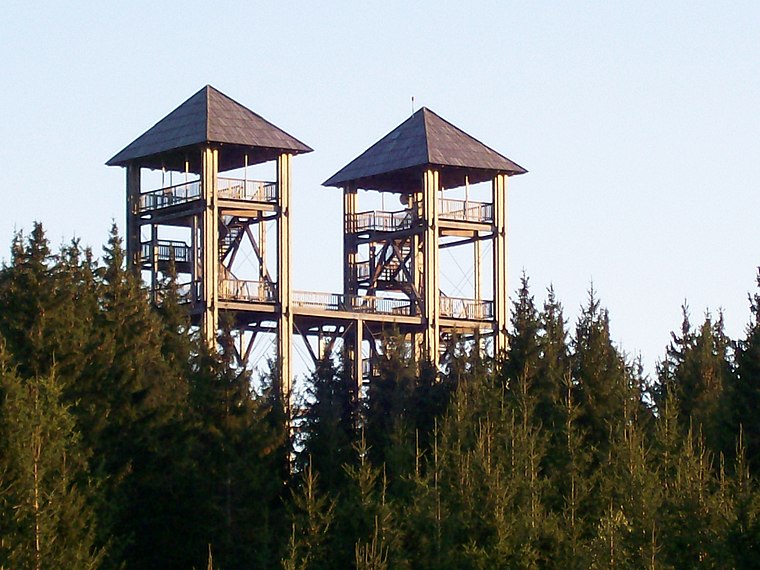
Photo: Wikimedia, Public domain.
Tower Power is a scenic viewpoint, which is situated 3 km northeast of Schönberg.
Places in the Area
Nearby places include Flatschach and Knittelfeld.
Flatschach
Village
Flatschach is a former municipality in the district of Murtal in Styria, Austria. Since the 2015 Styria municipal structural reform, it became a part of the municipality Spielberg.
Knittelfeld

Photo: Guschi, CC BY-SA 3.0.
Knittelfeld is a city in Styria, Austria, located on the banks of the Mur river. The name of the town has become notorious for the Knittelfeld Putsch of September 7, 2002, a party meeting of the Freedom Party of Austria, which resulted in the 2002 Austrian elections.
Großlobming
Village
Großlobming is a municipality in the district of Murtal in Styria, Austria. It is located on the banks of the river Mur. Großlobming is situated 6 km southeast of Schönberg.
Schönberg
- Category: burial
- Location: Spielberg, Murtal District, Styria, Austria, Central Europe, Europe
- View on OpenStreetMap
Latitude
47.22767° or 47° 13′ 40″ northLongitude
14.76219° or 14° 45′ 44″ eastOpen location code
8FVP6QH6+3VOpenStreetMap ID
way 180323833OpenStreetMap feature
landuse=cemeteryOpenStreetMap attribute
denomination=catholic
This page is based on OpenStreetMap, Wikidata, and Wikimedia Commons.
We’d love your help improving our open data sources. Thank you for contributing.
Satellite Map
Discover Schönberg from above in high-definition satellite imagery.
Places with the Same Name
Discover other places named “Schönberg”.
Notable Places Nearby
Highlights include 4WD Test Track and Area 24.
Nearby Places
Explore places such as Gästehaus Enzingerhof and Landhotel Schönberghof & Gästehaus Enzinger.
Styria: Must-Visit Destinations
Delve into Graz, Leoben, Bruck an der Mur, and Kapfenberg.
Curious Cemeteries to Discover
Uncover intriguing cemeteries from every corner of the globe.
About Mapcarta. Data © OpenStreetMap contributors and available under the Open Database License". Text is available under the CC BY-SA 4.0 license, except for photos, directions, and the map. Photo: Kmarka, CC BY-SA 3.0.