Hirtl
Hirtl is a building in Gaal, Murtal District, Styria. Hirtl is situated nearby to VW-Käfermuseum Gaal, as well as near the village Flatschach.| Tap on a place to explore it |
Places of Interest Nearby
Highlights include Schloss Wasserberg and Johannes Nepomuk-Kapelle.
Schloss Wasserberg
Castle

Photo: MangoMango, CC BY-SA 3.0.
Schloss Wasserberg is a castle, which is situated 1¼ km northwest of Hirtl.
Johannes Nepomuk-Kapelle
Church
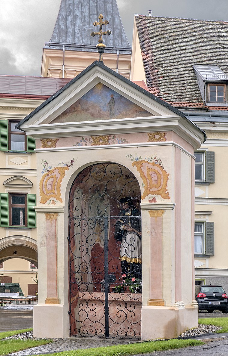
Photo: Thomas Ledl, CC BY-SA 3.0 at.
Johannes Nepomuk-Kapelle is a church, which is situated 1½ km northwest of Hirtl.
Pirkachkapelle
Wayside shrine

Photo: Thomas Ledl, CC BY-SA 3.0 at.
Pirkachkapelle is a wayside shrine, which is situated 1¼ km northwest of Hirtl.
Places in the Area
Nearby places include Flatschach and Spielberg.
Flatschach
Village
Flatschach is a former municipality in the district of Murtal in Styria, Austria. Since the 2015 Styria municipal structural reform, it became a part of the municipality Spielberg. Flatschach is situated 6 km southeast of Hirtl.
Spielberg

Photo: TheRunnerUp, CC BY-SA 4.0.
Spielberg is a municipality in the Murtal district in the Austrian state of Styria. In spite of being a small city of only around 5,400 inhabitants, it contributes significantly to the tourist industry of Styria, as the community is home of the Red Bull Ring race track.
Oberkurzheim
Hamlet
Oberkurzheim is a former municipality in the district of Murtal in Styria, Austria. Since the 2015 Styria municipal structural reform, it is part of the municipality Pöls-Oberkurzheim. Oberkurzheim is situated 9 km west of Hirtl.
Hirtl
- Type: Building
- Location: Gaal, Murtal District, Styria, Austria, Central Europe, Europe
- View on OpenStreetMap
Latitude
47.26078° or 47° 15′ 39″ northLongitude
14.69969° or 14° 41′ 59″ eastOpen location code
8FVP7M6X+8VOpenStreetMap ID
way 181918414OpenStreetMap feature
building=yes
This page is based on OpenStreetMap, Wikidata, and Wikimedia Commons.
We’d love your help improving our open data sources. Thank you for contributing.
Satellite Map
Discover Hirtl from above in high-definition satellite imagery.
Places with the Same Name
Discover other places named “Hirtl”.
Notable Places Nearby
Highlights include VW-Käfermuseum Gaal and Badeteich.
Nearby Places
Explore places such as Hirtl and Lerchbacher.
Styria: Must-Visit Destinations
Delve into Graz, Leoben, Bruck an der Mur, and Kapfenberg.
Curious Buildings to Discover
Uncover intriguing buildings from every corner of the globe.
About Mapcarta. Data © OpenStreetMap contributors and available under the Open Database License". Text is available under the CC BY-SA 4.0 license, except for photos, directions, and the map. Photo: Kmarka, CC BY-SA 3.0.