Stade municipal de l’Échet
Stade municipal de l’Échet is a pitch in Saint-Colomban-des-Villards, Arrondissement of Saint-Jean-de-Maurienne, Auvergne-Rhône-Alpes. Stade municipal de l’Échet is situated nearby to the peak Mont des Granges, as well as near Mont Cuinat.| Tap on a place to explore it |
Places of Interest Nearby
Highlights include Col du Glandon and Col de la Croix de Fer.
Col du Glandon
Mountain saddle
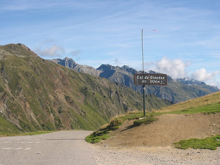
Photo: FabioDekker, CC BY-SA 3.0.
Col du Glandon is a high mountain pass in the Dauphiné Alps in Savoie, France, linking Le Bourg-d'Oisans to La Chambre. It is situated between the Belledonne, Grandes Rousses and Arvan-Villards mountain ranges, west of the Col de la Croix de Fer. Col du Glandon is situated 2½ km southwest of Stade municipal de l’Échet.
Col de la Croix de Fer
Mountain saddle

Photo: AlbertoBetulla, CC BY-SA 3.0.
Col de la Croix de Fer is a high mountain pass in the French Alps linking Le Bourg-d'Oisans and Saint-Jean-de-Maurienne. Col de la Croix de Fer is situated 3½ km south of Stade municipal de l’Échet.
L’Ouillon
Peak

Photo: Rémih, CC BY-SA 4.0.
L’Ouillon is a peak, which is situated 3 km southeast of Stade municipal de l’Échet.
Places in the Area
Nearby places include La Toussuire and La Toussuire.
La Toussuire
 La Toussuire is one of the six ski resorts of Les Sybelles in Maurienne Valley, the 4th biggest ski area in France, in the Auvergne-Rhône-Alpes region of Savoie. It measures 21.52 km2, with a population of 493 inhabitants.
La Toussuire
Hamlet
 La Toussuire is a hamlet, which is situated 5 km east of Stade municipal de l’Échet.
Le Corbier
Hamlet

Photo: Anthospace, CC BY-SA 3.0.
Le Corbier is a ski resort located in the commune of Villarembert, in the Savoie department and the Auvergne-Rhône-Alpes region of France. The resort is in the Les Sybelles region of the French Alps, it is the fourth largest ski area in France with 310 kilometres linked by lifts and pistes. Le Corbier is situated 6 km east of Stade municipal de l’Échet.
Stade municipal de l’Échet
- Type: Pitch
- Categories: recreation area, football, and sports location
- Location: Saint-Colomban-des-Villards, Arrondissement of Saint-Jean-de-Maurienne, Savoie, Auvergne-Rhône-Alpes, France, Europe
- View on OpenStreetMap
Latitude
45.25994° or 45° 15′ 36″ northLongitude
6.19417° or 6° 11′ 39″ eastOpen location code
8FQ8755V+XMOpenStreetMap ID
way 185195655OpenStreetMap feature
leisure=pitchOpenStreetMap feature
sport=soccer
This page is based on OpenStreetMap, Wikidata, and Wikimedia Commons.
We’d love your help improving our open data sources. Thank you for contributing.
Satellite Map
Discover Stade municipal de l’Échet from above in high-definition satellite imagery.
Notable Places Nearby
Highlights include Cascade du Pis du Zan and Mont des Granges.
Nearby Places
Explore places such as Pont de l’Échet and Mont Cuinat.
Savoie: Must-Visit Destinations
Delve into Chambéry, Aix-les-Bains, Val-d’Isère, and Bourg-Saint-Maurice.
Curious Pitches to Discover
Uncover intriguing pitches from every corner of the globe.
About Mapcarta. Data © OpenStreetMap contributors and available under the Open Database License". Text is available under the CC BY-SA 4.0 license, except for photos, directions, and the map. Photo: Mrhugues, CC BY-SA 3.0.